The county seat is the City of Boulder, the largest municipality in Boulder County. Other incorporated towns and cities include: Erie, Jamestown, Lafayette, Longmont, Louisville, Lyons, Nederland, Superior, and Ward. View all towns and cities within Boulder County. The estimated population of Boulder County in 2023 was 328,317.
About Boulder County Government
Priorities
From visionary open space, land use, and sustainability policies to forward-thinking public services programs, our county government helps foster a vibrant, healthy, and active community.
View Boulder County’s Vision and Values for more details about the county’s major priorities and focus areas.
Environmental Sustainability
Boulder County is a national leader in innovative sustainability efforts. The county’s EnergySmart Services was honored with a national Innovation in Government Award. The Zero Waste initiative advocates for eliminating waste by modeling resource management on the waste-free and self-sustaining systems found in nature.
Open Space Conservation
The county has demonstrated a commitment to preserving and maintaining its open spaces. Protecting open lands remains a core value of the government today. By providing activities, events, and services that engage the community in open space conservation and recreation, Boulder County helps to ensure that critical wildlife habitats, farms, and areas for recreation will be around for generations to come.
Supportive Community Programs
Programs such as Homeless Solutions for Boulder County, the Area Agency on Aging, the Community Action Program, Workforce Boulder County, and the Boulder County Housing Authority provide residents with the tools and support they need. Boulder County works on important issues including food safety, medical and mental health services, wellness and nutrition, financial and transportation assistance, disease prevention, substance abuse and addiction, and aging services.
Transportation Services
Boulder County’s transportation programs are designed to increase mobility and reduce congestion throughout Boulder County. Providing a reliable network of roadways, bikeways, trails, and transit service to the citizens of Boulder County while ensuring the health, safety, and welfare of the public is our goal. Boulder County coordinates, provides, and maintains a high quality, safe, and multi-modal transportation networks and related services in a responsive manner, within budget, on schedule, resulting in high customer satisfaction.
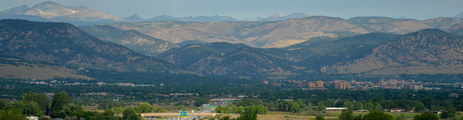
Geography
Boulder County’s landscape features everything from farmland and rolling grasslands in the plains to the high peaks of the Continental Divide.
Located in north-central Colorado, northwest of Denver, the county’s landscape includes several dense urban centers surrounded by rural buffer zones and mountain communities, plus portions of Rocky Mountain National Park.
- 741 square miles
- Eastern slope of the Rocky Mountains
- Elevation: Ranges from approximately 5,000 to more than 14,000 feet
Due to Boulder County’s unique land use decisions, most of its unincorporated areas remain rural in nature with the exception of the Niwot and Gunbarrel communities which were planned in accordance with the build out of the IBM facility at Hwy 52 and CO 119.
Major Employers
Academia and Scientific Research in Boulder County
Education
- University of Colorado at Boulder
- Naropa University
- Front Range Community College
- Boulder Valley School District
- St. Vrain Valley School District
Scientific Facilities
- National Center for Atmospheric Research (NCAR)
- National Institute of Standards and Technology (NIST)
- National Oceanic and Atmospheric Administration (NOAA)
- National Ecological Observatory Network (NEON)
History
The plains are part of what the explorer Stephen Long erroneously labeled the Great American Desert. It is here that many of Boulder County’s towns and cities are located – Longmont, Erie, Lafayette, Louisville, and Superior. Some of the resources found in the plains are rich, irrigated farmlands and rolling pastures, lignite coal, iron ore and small amounts of oil and gas. The land is accented with lakes and ditches which are used mainly for agricultural purposes, the result of human effort to convert the dry soil into productive land.
To the west of the plains are the foothills. Nestled in the valleys against the first, prominent rock formations are Lyons, Boulder and Eldorado Springs. You can see the red rock fountain formation rising above the plains. This area is the source for construction stone, some of it used to build the University of Colorado.
Twisting between and around the rapidly ascending rock formations are the canyons, which serve as gateways to the mountains. They are also the drainage ways, which bring the waters of the North and South St. Vrain, Left Hand, North and South Boulder creeks to the plains. As the terrain rises, you can see signs of Boulder County’s mining towns and history. Of these, a few have survived as communities (such as Gold Hill and Eldora), but only Jamestown, Ward and Nederland are incorporated towns.
The area west of the Peak to Peak Highway is largely owned by the federal government and managed by the U.S. Forest Service and the National Park Service. This area extends to the Continental Divide, which forms the western boundary of Boulder County. Boulder County contains major portions of Rocky Mountain National Park, Indian Peaks Wilderness and Roosevelt National Forest.
From dry land wheat farms to alpine tundra, from urban parks to wilderness, from “high-tech” recreation centers to historic landmarks, Boulder County is a wonderful conglomeration of nature’s gifts and human handiwork.
Historical Timeline – County & Courthouse
- 1803: Thanks to the Louisiana Purchase, territory within what is now Boulder County becomes part of the United States
- 1858: Gold was discovered in Dry Creek, stimulating the Pikes Peak Gold Rush
- 1859: Coal was discovered in the Marshall area southeast of Boulder; The first record of modern settlement in Boulder County
- 1861: The Colorado Territory was created
- Boulder one of 17 counties represented in the first Territorial Assembly
- Native Americans were the first inhabitants of the county
- Followed by settlers, gold miners, farmers, coal miners and traders
- 1866: Boulder County’s first newspaper, the Valmont Bulletin, began publication (later renamed the Boulder Valley News)
- 1869: The first Boulder County Fair took place; The Boulder County Agricultural Society was founded
- 1873: The first railroad was extended to Boulder County
- 1882: Cornerstone of the original Boulder County Courthouse was laid
- Building marked the official designation of a public square
- Meeting place of the Boulder County Commissioners
- Original structure was considered elaborate for a small pioneer town
- 1890: The Boulder Daily Camera was founded
- 1894: The Great Boulder Flood
- 1898: The Chautauqua Auditorium was opened on July 4th
- 1910: The Boulder County coal miners’ strike
- 1932: The original courthouse and many records were destroyed by fire
- 1934: New courthouse built on the same site
- 1962: Two wings were added to the courthouse complex
- 1970: The Boulder County Comprehensive Plan was adopted
- 1973: Boulder County’s first open space land was purchased
- 1976: Voters approved the Danish Plan, a 2% growth limitation referendum
- 1986: The Lafayette-Louisville Downtown Revitalization Partnership was established
- 1993: The Boulder County Historic Preservation Ordinance was adopted