Floodplain mapping updates reflect ongoing work by state and federal agencies to refine flood risk information for Boulder County’s waterways. These updates incorporate new studies, public review periods, and FEMA map revisions to ensure that floodplain regulations are based on the most accurate and current data available. Learn more on the Building, Safety and Inspection homepage.
Background
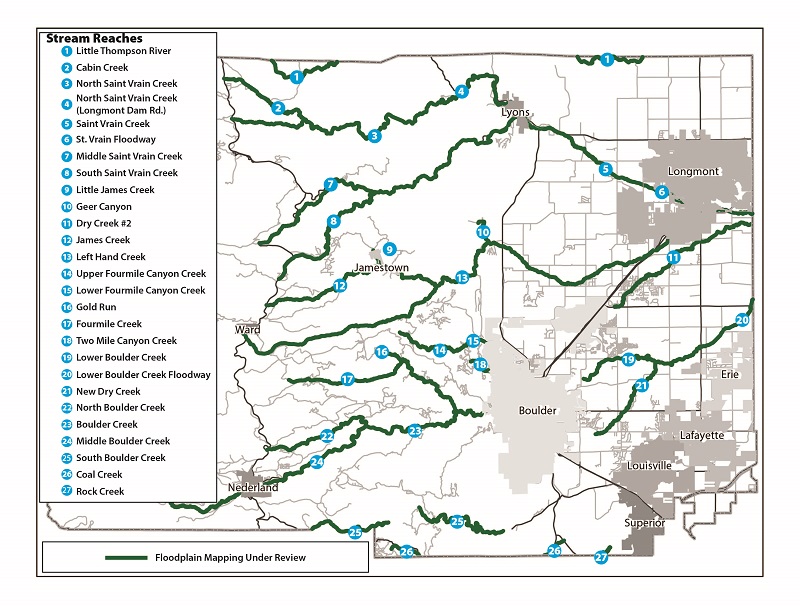
Following the 2013 Flood, the Colorado Water Conservation Board (CWCB) initiated a program to re-map the predicted 1% annual chance flood zone (100-year floodplain) of the most affected waterways (shown in the image below). The program was called the “Colorado Hazard Mapping Program,” or CHAMP. Draft map data and related flood studies for the CHAMP– studied reaches were adopted by the Board of County Commissioners (BOCC) through Docket Z-17-0001 and Docket Z-17-0002. In September 2019, FEMA released Preliminary Flood Insurance Rate Maps (FIRMs) for the same CHAMP reaches, refining the draft maps. The Preliminary FIRMs were adopted by the BOCC, replacing the draft map data via Docket Z-19-0001 to allow the county to base floodplain regulations on the best available data.