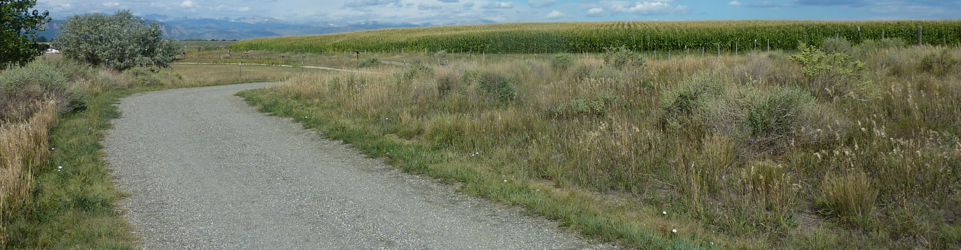
The Rock Creek Trail is a soft-surface trail that follows Rock Creek from the Coalton Trailhead in Superior through the Carolyn Holmberg Preserve connecting with the Coal Creek Trail in Lafayette.
Rock Creek Trail
Trails
-
Rock Creek Trail
12 miles – Easy


Trail Connections
The Rock Creek Trail connects with these trails and properties.
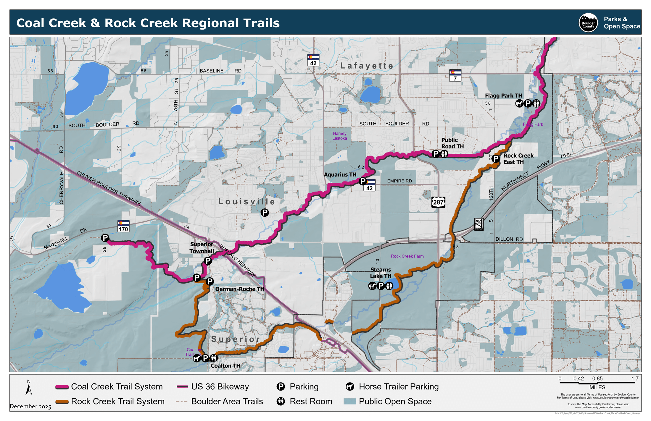
Parking
The Stearns Lake parking lot can accommodate 15 cars and 2 horse trailers. The parking lot can only be accessed from Dillon Rd. and 104th St. (there is no access from 287 through Rock Creek Farm).
The lot at the Coalton Trailhead can accommodate 27 cars, 2 handicapped spaces and 3 horse trailers (1 with horse hitching rails).
Picnic Areas
Group shelters available at Stearns Lake Trailhead and the Coalton Trailhead.
Restrooms
Available at the Stearns Lake Trailhead and the Coalton Trailhead.
Keep in Mind
- There are two missing links along the route in Broomfield.
- Regional trails and regional trail connectors are open to commuters 24 hours per day. Trailheads close at sunset and parking is not allowed between sunset and sunrise.
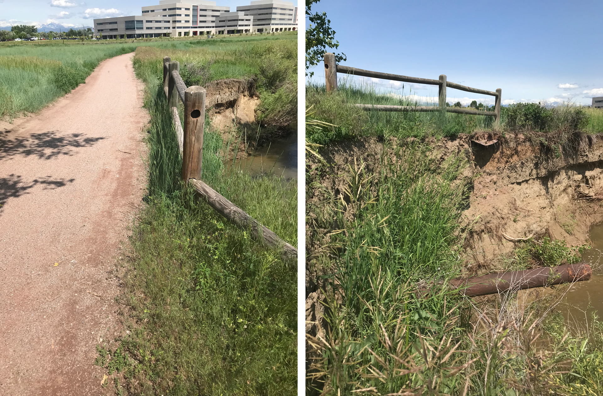
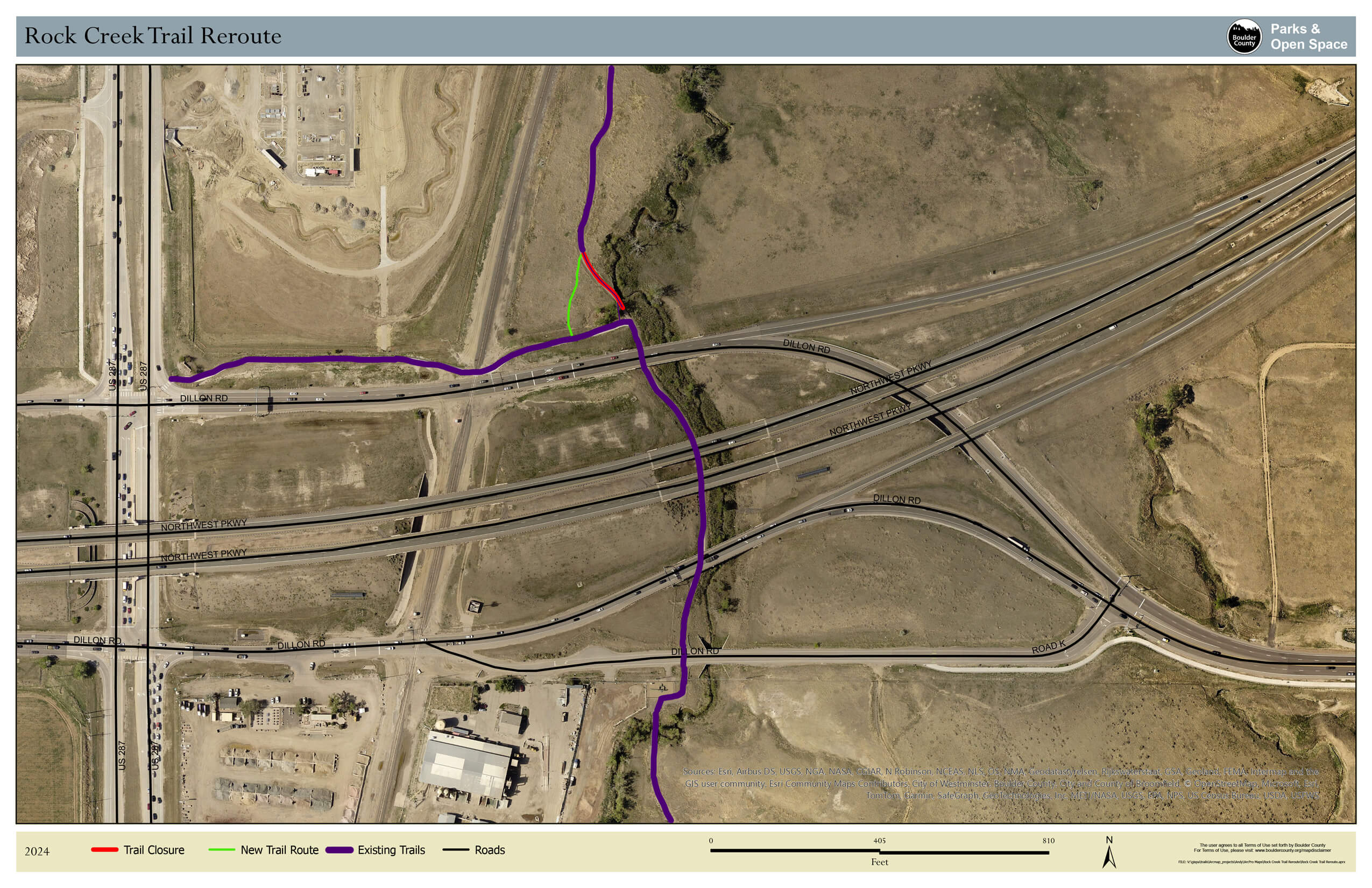
A section of trail just north of Dillon Road is eroding into the creek. Crews built a new trail that takes users west of the eroding section.
Mammals
- Black tailed prairie dog
- Coyote
- Cottontail rabbits
- American mink
Reptiles & Amphibians
- Bull snake
- Woodhouse’s toad
Insects
- Checkered white painted lady
- Green striped grasshopper
- Speckle-winged rangeland grasshopper
Birds
- Red tailed hawk
- Great blue heron
- Great horned owl
- Western meadowlark
- American kestrel
- Golden eagle
- Bald eagle
- Western kingbird
- Coopers hawk
- Swainson’s hawk
- Common yellowthroat
- Belted kingfisher
- Ferruginous hawk
- Red-winged blackbird
- Northern harrier
Trees & Shrubs
- American plum (Prunus americana)
- Desert false indigo (Amorpha fruticose)
- Eastern cottonwood (Populus deltoides)
- Fourwing saltbush (Atriplex canescens)
- Purple groundcherry (Quincula lobate)
Wetland Plants
- Narrow-leaved cattail (Typha angustifolia)
Yellow Wildflowers
- Curlycup gumweed (Grindelia squarrosa)
- Upright prairie coneflower (Ratibida columnifera)
- Common sunflower (Helianthus annuus)
- Rubber rabbitbrush (Ericameria nauseosa)
Pink/Purple Wildflowers
- Blue vervain (Verbena hastata)
- Showy milkweed (Asclepias speciose)
White Wildflowers
- White prairie aster (Symphyotrichum falcatum)
The 12-mile Rock Creek Regional Trail is primarily a soft-surface trail that parallels Rock Creek from Superior, through Carolyn Holmberg Preserve at Rock Creek Farm to the Rock Creek and Coal Creek Confluence in Lafayette. For locals, the trail offers access to nature just steps from home while it also provides a corridor for wildlife.
Starting in 1990, the Coal Creek and Rock Creek Trails project is the product of an area-wide partnership. Boulder County, the Town of Superior, the cities of Louisville and Lafayette, and the Urban Drainage and Flood Control District, all worked and will continue to work together to ensure the trail’s completion.