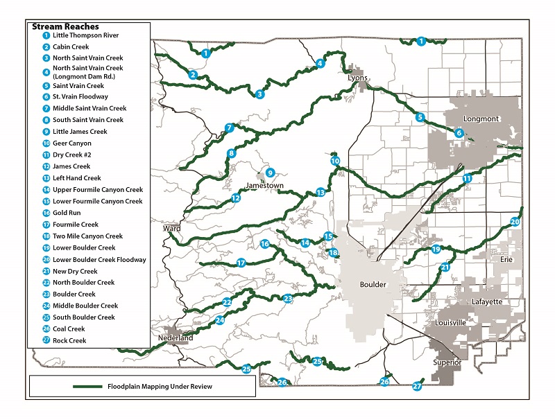
Boulder County Floodplain Map
The interactive map linked in the sidebar, shows detailed flood risk zones and related FEMA map amendments that are currently regulated throughout unincorporated Boulder County as Floodplain Overlay Zoning District. This map will update as new FEMA maps become effective throughout Boulder County and as the Boulder County Board of County Commissioners (BOCC) adopts best available information.
The Boulder County and FEMA Regulatory Flood Risk Zones were updated on October 24, 2024 to reflect changes to the Floodplain Overlay District based on FEMA’s Physical Map Revision reflecting the Colorado Hazard Mapping Program (CHAMP) study. The zoning map amendments were adopted by the BOCC via Docket Z-23-0001.
Historical Flooding and Floodplain Mapping in Boulder County
Historical records confirm the destructive force of floodwaters throughout Boulder County. In addition to the 2013 flood, large, damaging flood events occurred in 1894 and 1969. Regular, smaller flood events have periodically affected county watersheds throughout time.
In 1965, Boulder County first suggested managing development in floodplains to improve the safety of residents and their property. In 1968, FEMA introduced federal regulations to manage development in floodplains nationwide. Boulder County adopted floodplain regulations for the first time in 1969 even though they weren’t incorporated into the Land Use Code until 1972.
What is the Mapped Floodplain?
Floodplains are a natural part of the environment. The floodplain is the area of land along a waterway (stream, creek, river, etc.) that is susceptible to inundation by floodwaters. The floodplain plays an important role in conveying flood waters and also has an ecological role such as improving water quality and recharging groundwater, providing aquatic species and wildlife habitat, creating recreational areas, and producing cultural value.
The regulatory floodplain delineates the predicted flood height and inundation boundaries of a flood that has a 1% chance of occurring in any given year. This is also known as the “100-year flood”. The predicted water level during the 1% annual chance event is called the base flood elevation. The regulatory floodplain is what the Federal Emergency Management Agency (FEMA) and local authorities use to regulate public and private development and calculate flood insurance. In Boulder County, the regulatory floodplain consists of regulatory FEMA Floodplain zones together with regulatory Boulder County Floodplain zones, and is referred to as the “Floodplain Overlay Zoning District”.
Regulatory floodplain maps are updated to reflect physical changes that have occurred to waterways from development and natural causes. In addition, as technology advances, hydraulic engineers can incorporate both more accurate topographical information and more refined discharge calculations for the 100-year flood resulting in more precise prediction of flow paths and flood elevations. Floodplain maps are generated by Professional Engineers using ground survey, topographical data, rainfall and river flows, and modeling software to produce flood inundation maps and profiles.