Parks & Open Space and the Sheriff’s Office Wildland Fire Management Program plan to conduct prescribed burns when conditions allow. Smoke and flames may be visible for up to 72 hours. There may be heavy smoke in the air. Please do not call 911 since a controlled burn is not an emergency. The areas will be monitored to ensure fires are completely out.
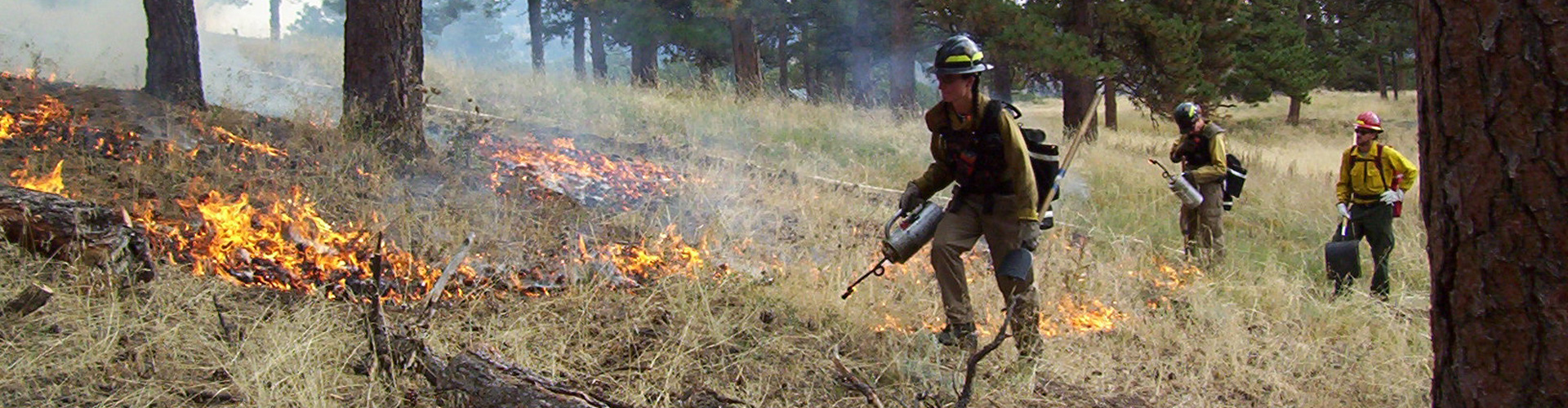
Prescribed Burn Projects
Agriculture burning is done to remove vegetation to control weeds and prepare areas for reseeding. Irrigation ditches are burned to remove unwanted vegetation for improved water delivery, nutrient cycling, and planting success.
Burn projects depend on weather conditions, including relative humidity, fuel moisture, and wind. Projects will only proceed when conditions are suitable. Fire managers will monitor all projects until they are called out. There may be heavy smoke in the air. Please do not call 911 since these controlled burns are not emergencies.
Projects may take place anytime between Oct. 1 and May 31.
Agriculture Broadcast Projects
-
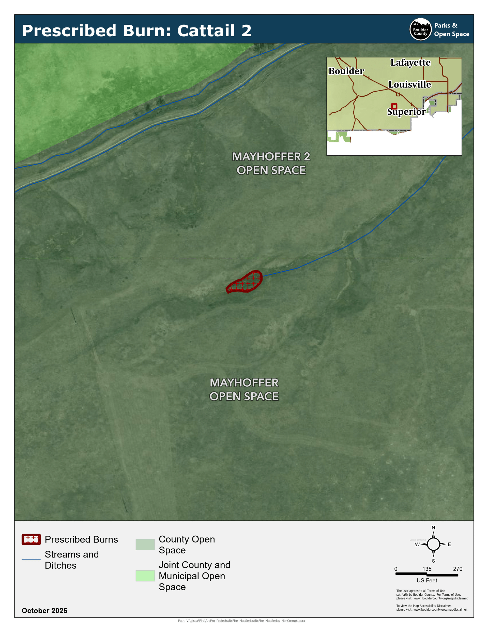
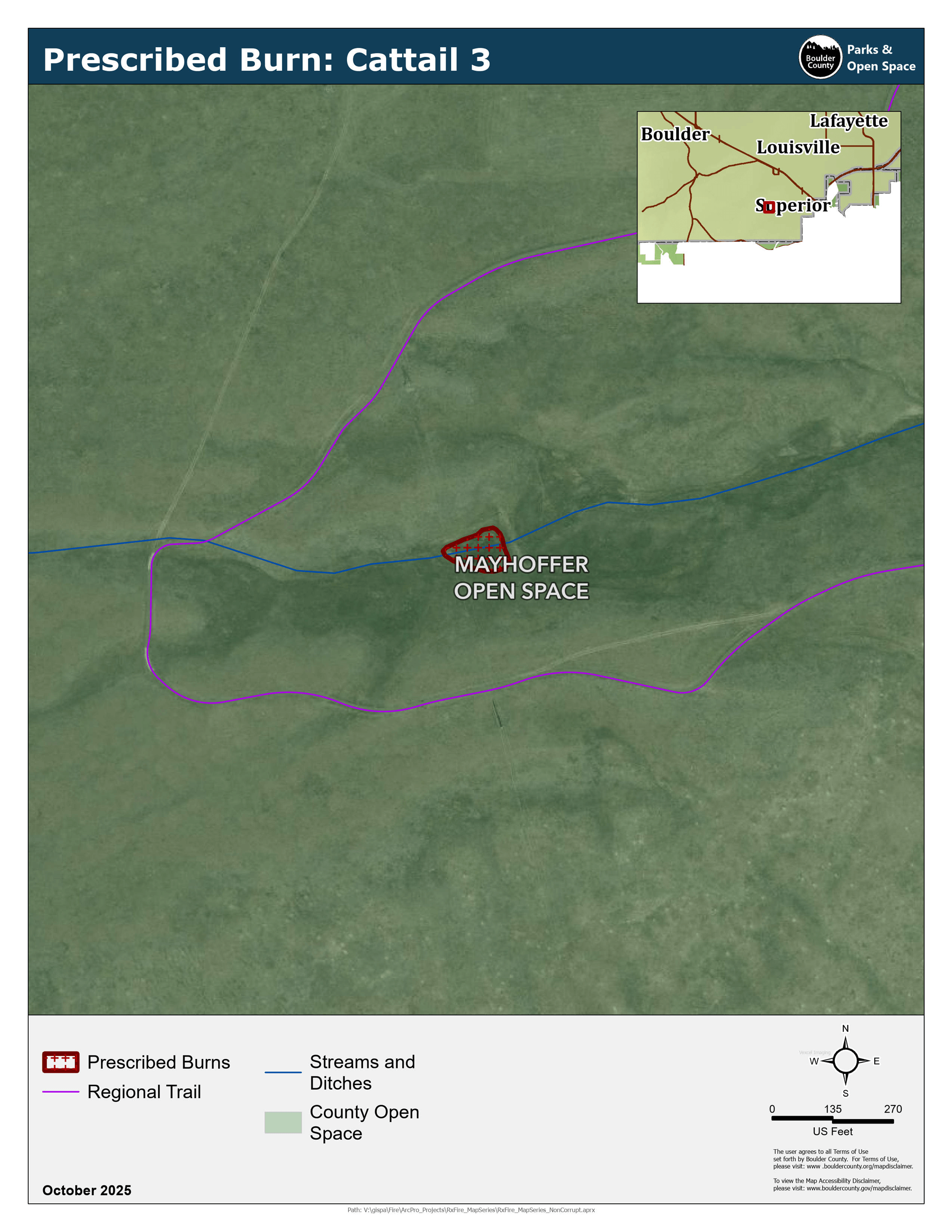
Cattails 1, 2, 3 (Superior)
Bush (Coal Creek Dr) and Mayhoffer (McCaslin Blvd) properties.
These three ponds will be burned to reduce the amount of cattails and restore their function as sources of water for cattle.
1.4, 0.17, 0.21 acres.- Cattail 1 Map
- Cattail 2 Map Completed Oct. 9
- Cattail 3 Map Completed Oct. 9
-
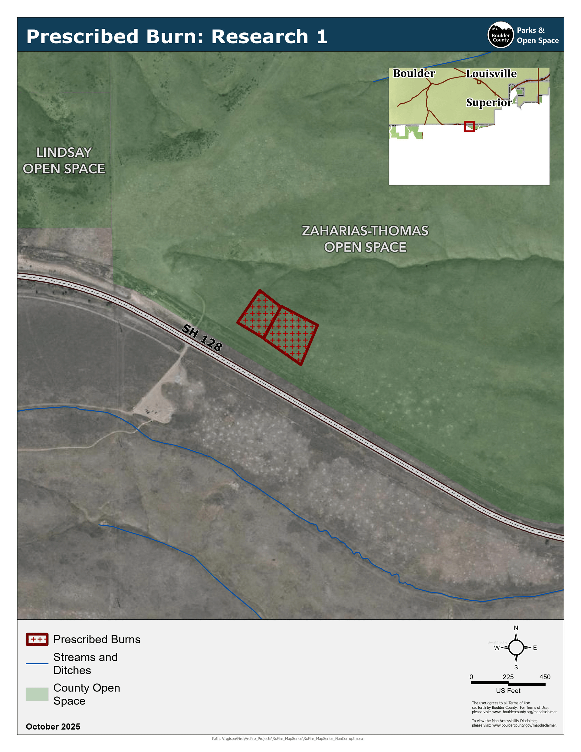
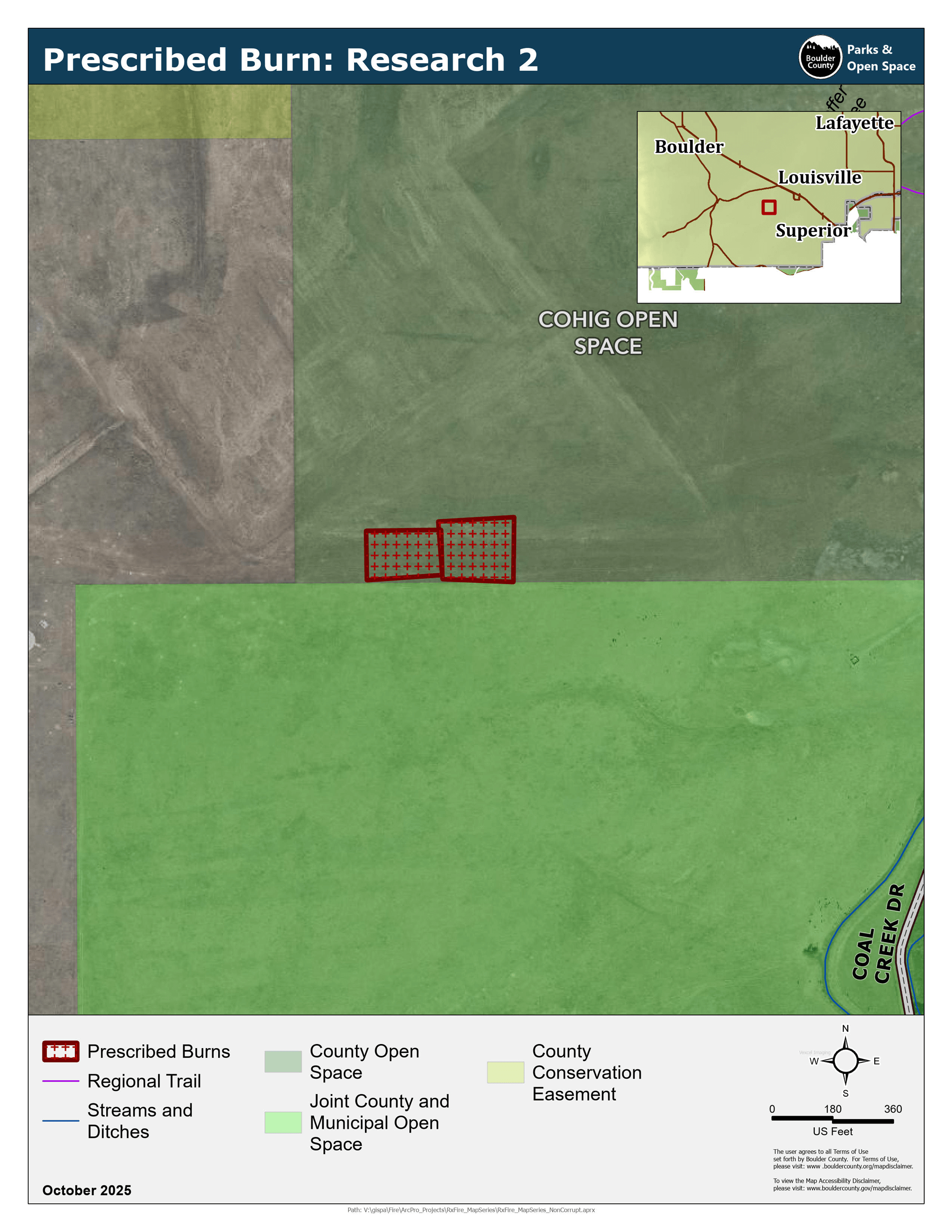
Research 1, 2 (Superior)
Cohig (Coal Creek Dr) and Zaharias-Thomas (McCaslin Blvd and 128) properties.
Two units will be burned as part of a county-funded research project with the University of Colorado to look at variations in grassland fuels and mitigation strategies.
1.4 acres, 0.9 acres.- Research 1 Map
- Research 2 Map Completed Oct. 9
-
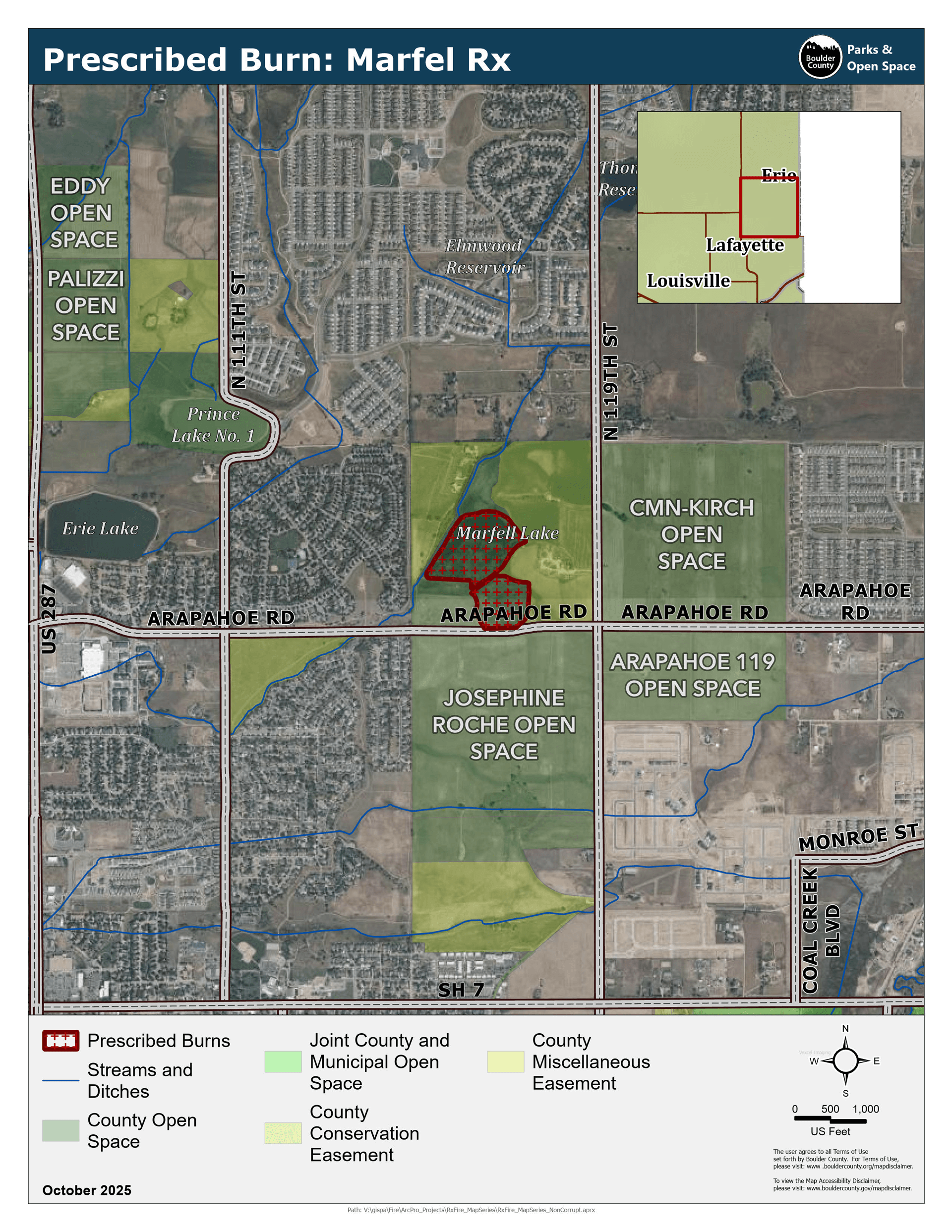
Marfell Lakes (Lafayette/Erie)
Arapahoe Rd. and 119th St.
Two units will be burned to reduce the amount of cattails and increase the capacity of the lakes.
20.4 acres, 10.9 acres.
Marfell Lakes Map -
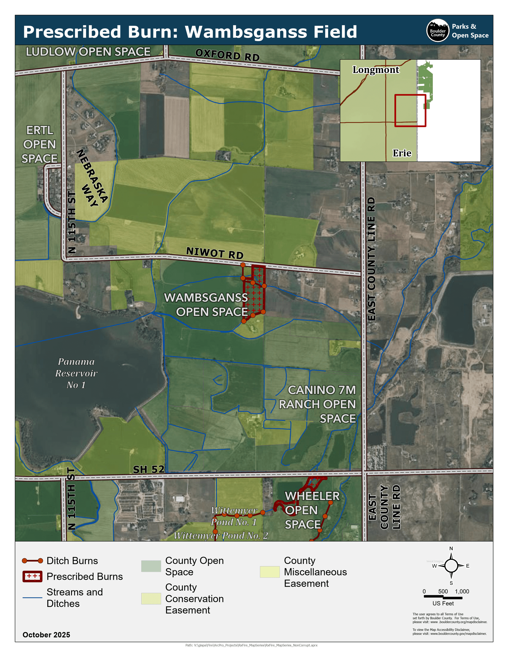
Wambsganss (Erie)
Niwot Rd. and E. County Line Rd.
This project will remove vegetation from the ditch and adjacent field to improve water conveyance.
14 acres.
Wambsganss Map -
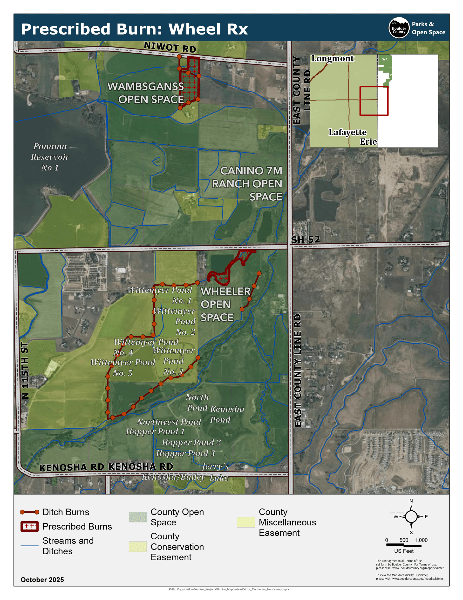
Wheel (Longmont/Erie)
Wheeler property (Hwy 52. and E. County Line Rd.)
This project will reduce the amount of cattails for further maintenance on the culvert under Hwy 52 to improve water conveyance.
5.9 acres.
Wheel Map -
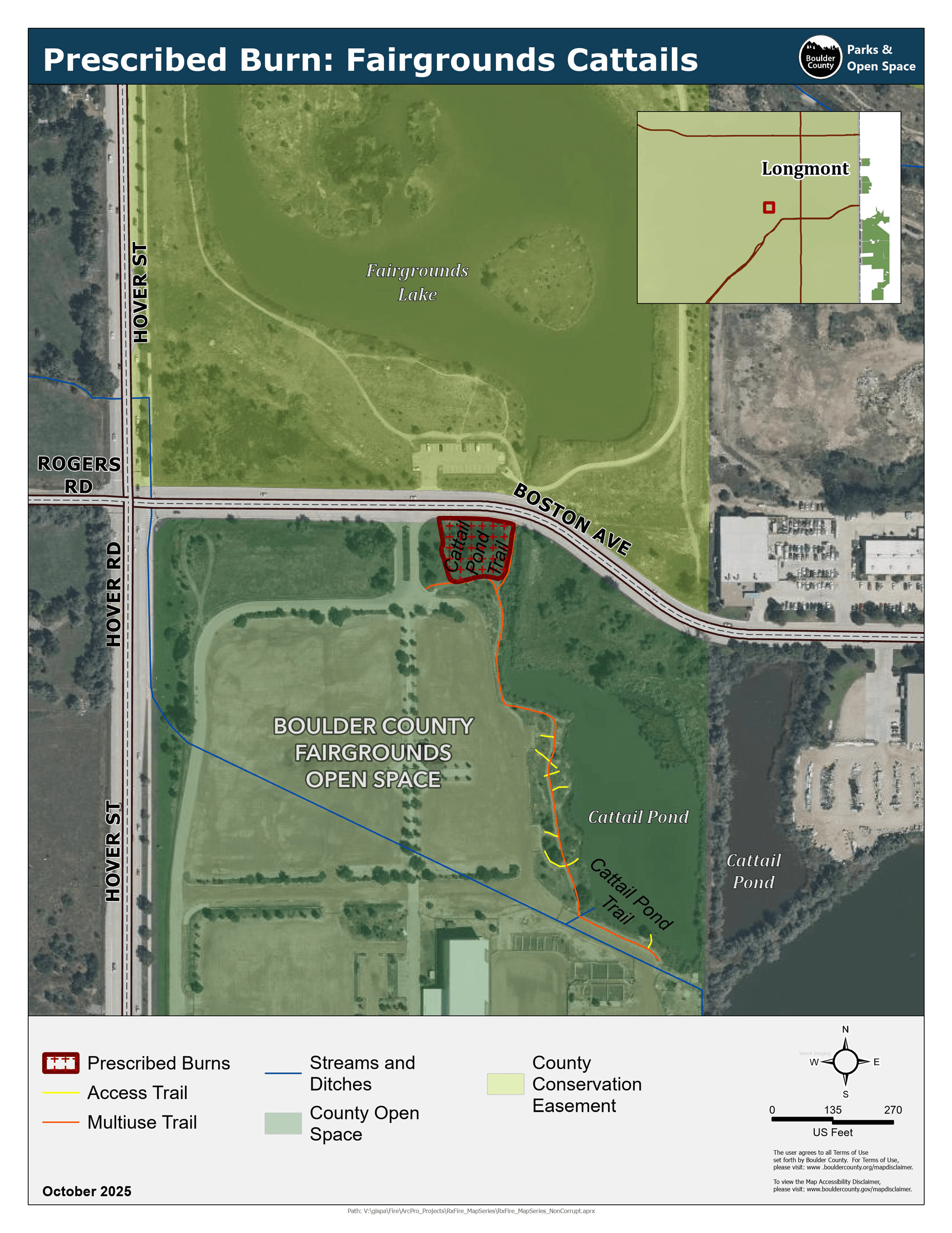
Fairgrounds (Longmont)
Boston Ave. and Hoover St.
This project will remove cattails and improve the capacity of the stormwater-runoff catchment basin.
0.44 acres.
Fairgrounds Map -
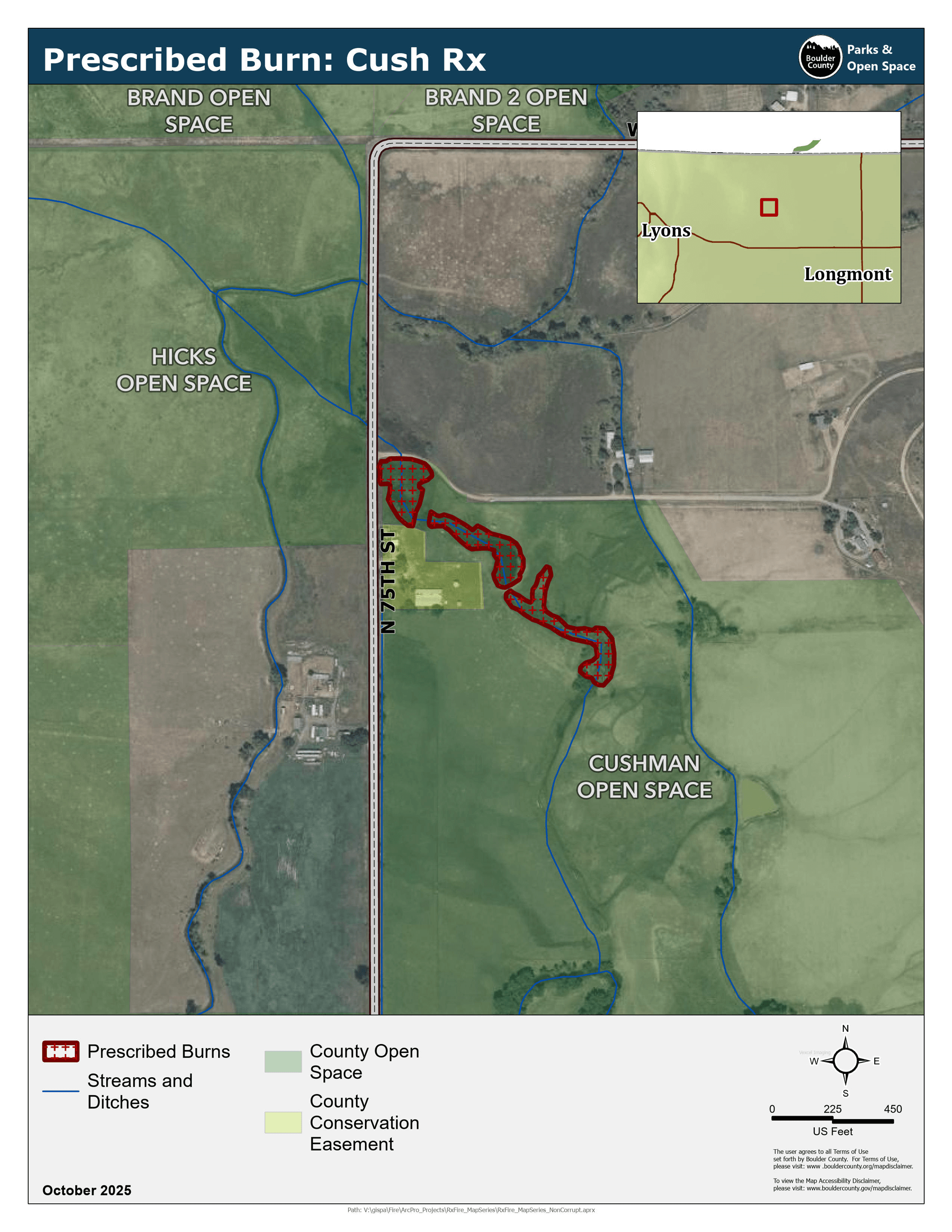
Cush (Longmont)
Cushman (75th St. and Woodlawn)
These three ponds will be burned to reduce the amount of cattails and restore their function as sources of water for cattle.
0.7, 0.7, and 0.9 acres.
Cush Map
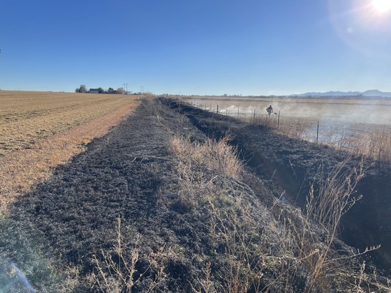
Irrigation Ditch Projects
-
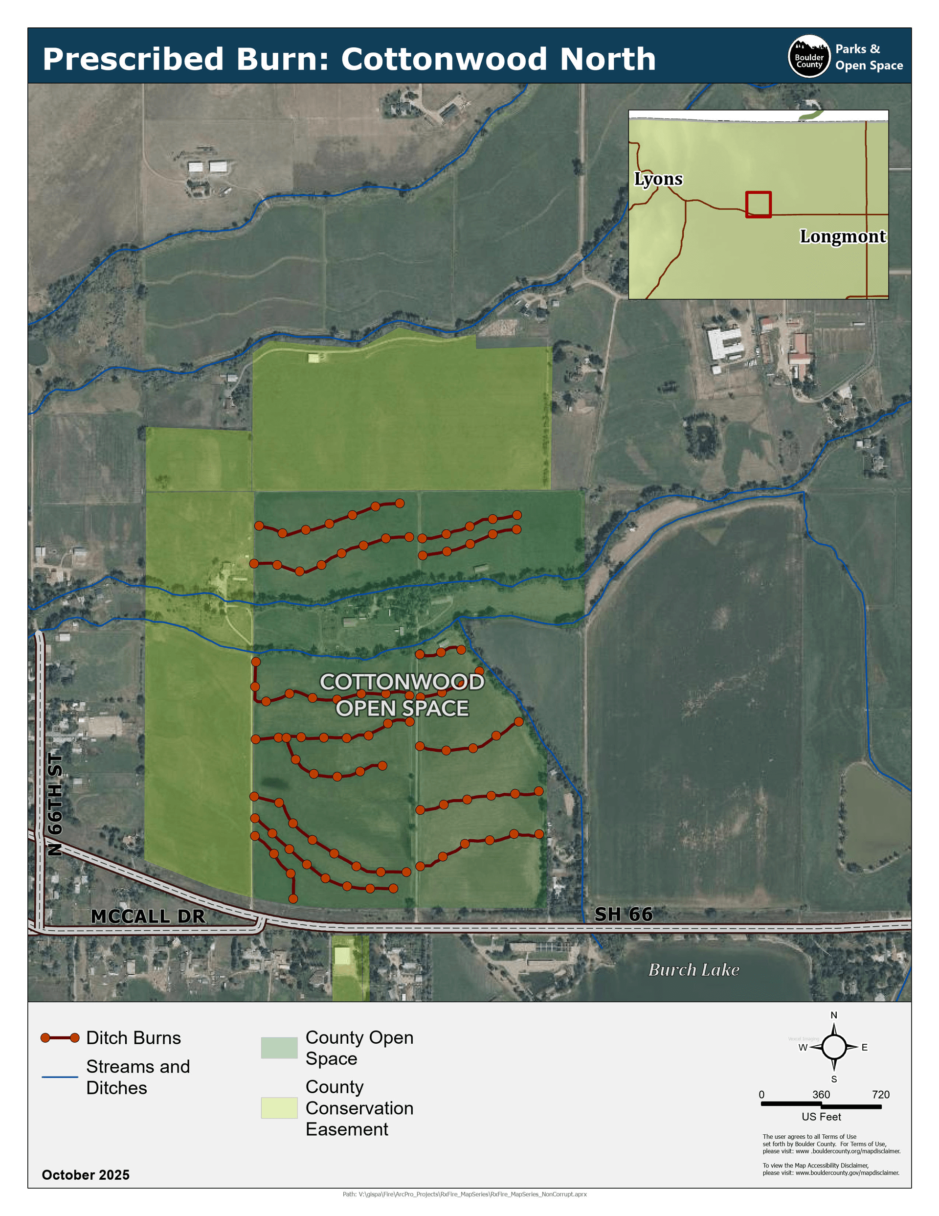
Cottonwood (Hygiene)
Hwy 66 and N. 66th St.
This project will remove vegetation from 14 field laterals to improve water conveyance.
11,329 ft. total.
Cottonwood Map -
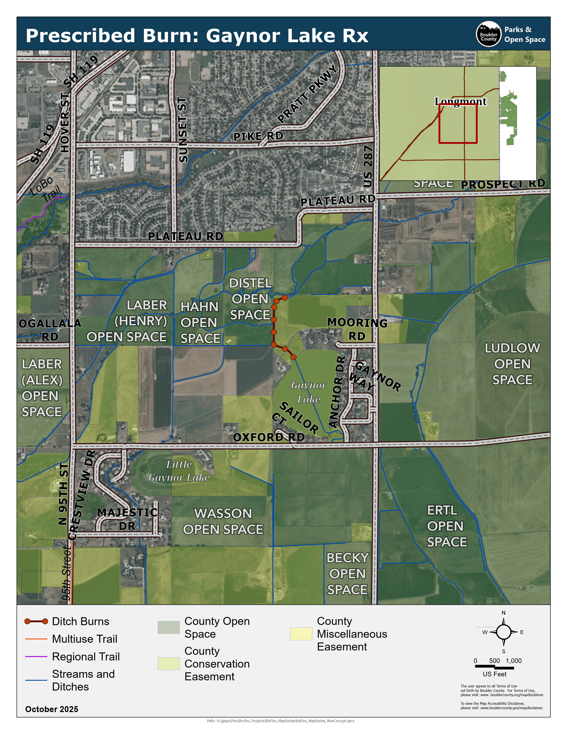
Gaynor Lake (Longmont)
Hwy 287 and Mooring Rd.
This project will reduce vegetation in the ditch and improve water conveyance.
1,624 ft.
Gaynor Lake Map Completed Nov. 11 -
Lagerman (Longmont)
N 67th St. and Pike Rd.
This project will remove vegetation so that the ditch can be dug out to better convey water.
2,638 ft.
Lagerman Map -
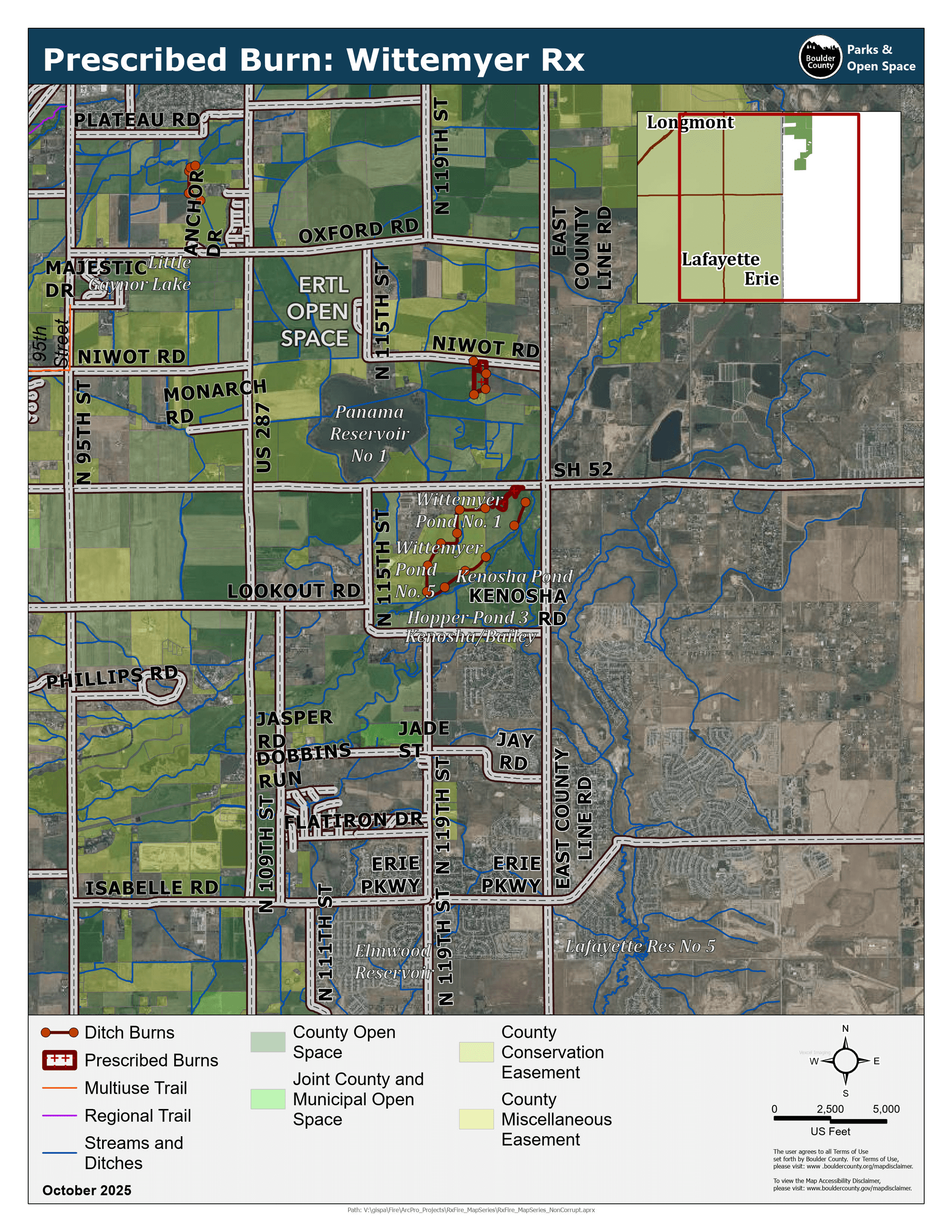
Wittemyer Ponds (Longmont)
Hwy 52. and E. County Line Rd.
This project will reduce the amount of vegetation in the ditch to improve water conveyance.
9,107 ft.
Wittemyer Ponds Map
2024-25 Burn Projects
During the 2024–25 season, 38,872 feet of ditch were successfully treated with prescribed burning.
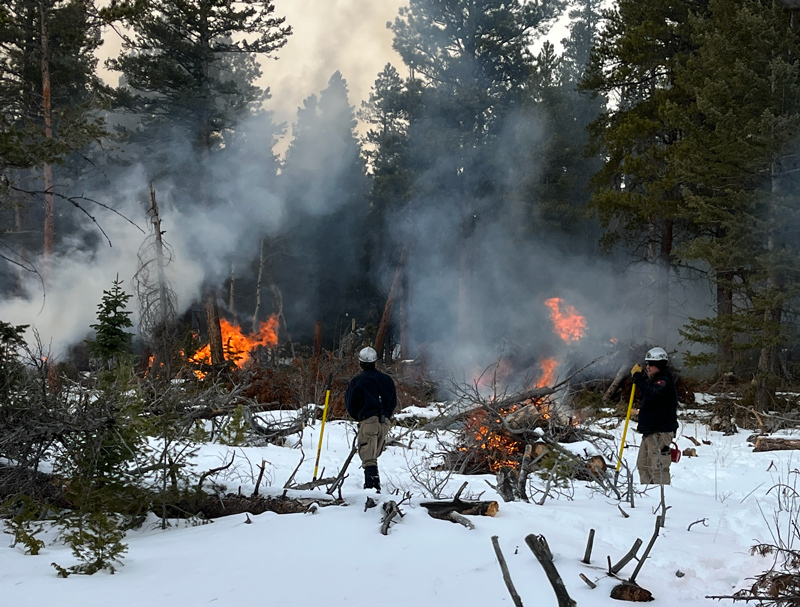
Slash pile burns are conducted to reduce the amount of fuel on the ground as a result of thinning operations. Burns are usually scheduled when there is a winter weather system in the area.
Operations will be conducted only when conditions ensure safe fire operations and containment. Burn projects depend on ideal weather conditions, including relative humidity, fuel moisture, and wind. Projects will only proceed when conditions are suitable. Fire managers will monitor all projects until they are called out. Please do not call 911 since these controlled burns are not emergencies.
Project can occur any time in the winter as snow conditions allow.
Slash Pile Burn Projects
-
Hall Ranch
East of Ralph Price Reservoir.
1,000+ piles that were constructed as part of the 2023 CoSWAP and 2024 HHR fuels reduction projects. -
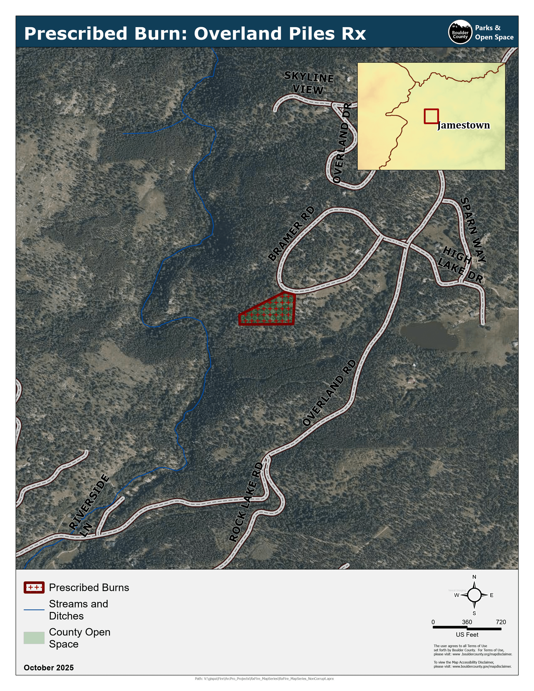
Overland
Northwest of Jamestown.
15 piles that were constructed in 2024 as part of a fuels reduction project.
Overland Map -
Riverside Ranch
South of Ralph Price Reservoir.
3,000 to 4,000 piles that were constructed as part of the 2024 HHR fuels reduction project. -
Reynolds Ranch
Southeast of Nederland.
20-30 piles that were constructed by Youth Corp in 2025 to thin out the regeneration in the patch cuts across the property. -
Sherwood Gulch / Mud Lake
Northwest of Nederland.
12 piles that were constructed in 2024 as part of a fuels reduction project implemented by the SO Fire Management Program. -
Loukonen Outlots
Near US 36 and Ron Stewart Preserve at Rabbit Mountain.
The burn window has expired and the Nelson Loop project is currently on hold.
The Nelson Loop project is an 816-acre project being implemented as part of a restoration-based prescription designed to re-introduce fire to the ecosystem to maintain current forest structure and reduce the number of small-diameter trees that are encroaching into the meadows. The planned operations will also have the benefit of reducing the amount of fuel available in the event of a wildland fire.
Six units for a total of 198 acres have been identified for ignitions. These units build upon the previous work conducted in 2012 and 2023. All ignitions will be done by hand and no aircraft will be used. Conditions will be monitored closely before, during, and after any ignitions. The fire will be monitored until declared out.
During ignitions, Hall Ranch will be closed. The park will open again once ignitions are complete, and fire managers deem it safe to do so.
- A burn window was set for Oct. 13 – Dec. 20.
- Burn operations are usually scheduled for one to three consecutive days.
- Park will be closed during ignition days and will reopen when deemed safe and if not otherwise closed due to muddy conditions.
- Smoke and flames may be visible for up to 72 hours after a controlled burn. There may be heavy smoke in the air. Please do not call 911 since a controlled burn is not an emergency. The areas will be monitored to ensure fires are completely out.
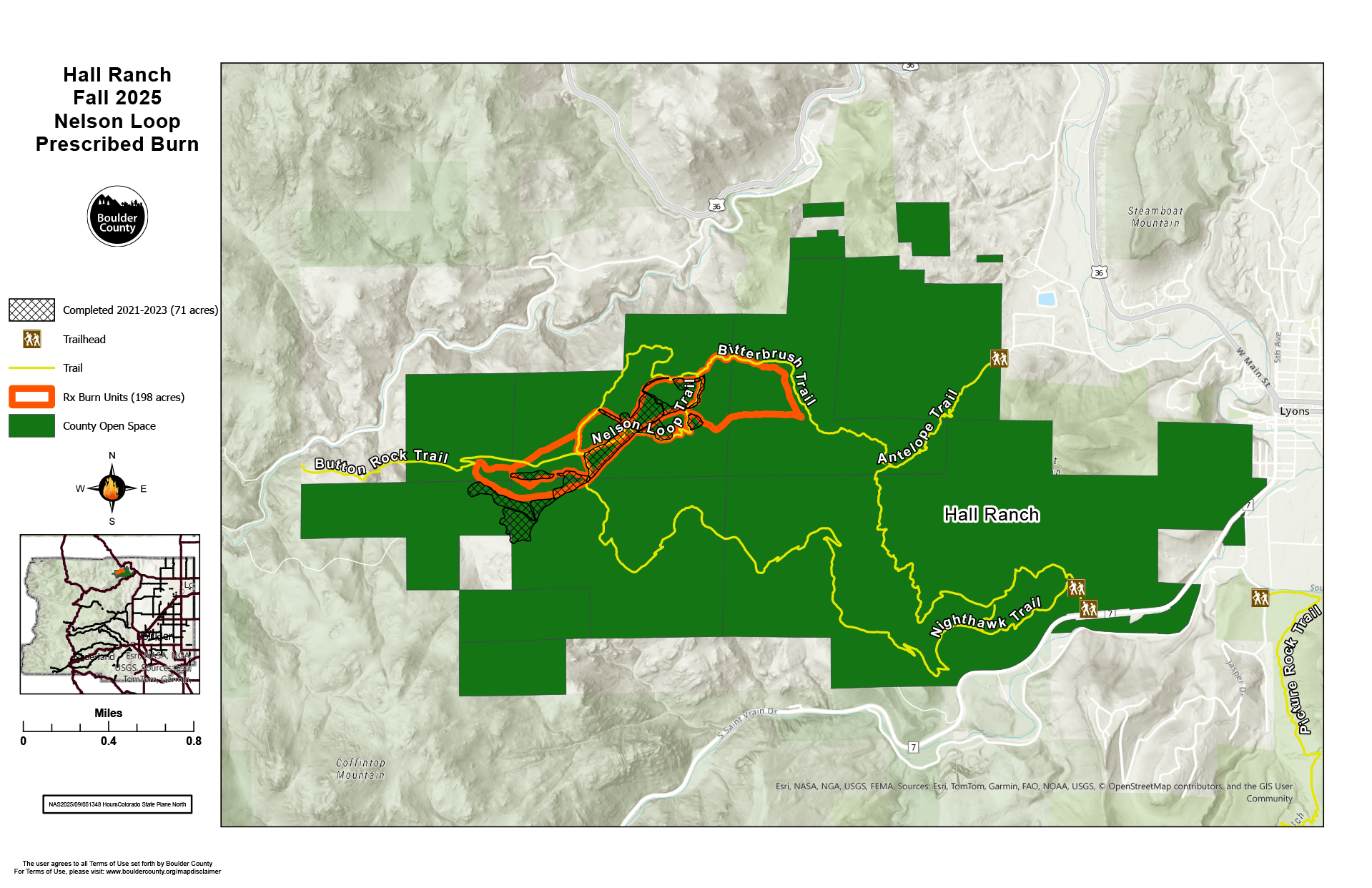 Nelson Loop Prescribed Burn Map
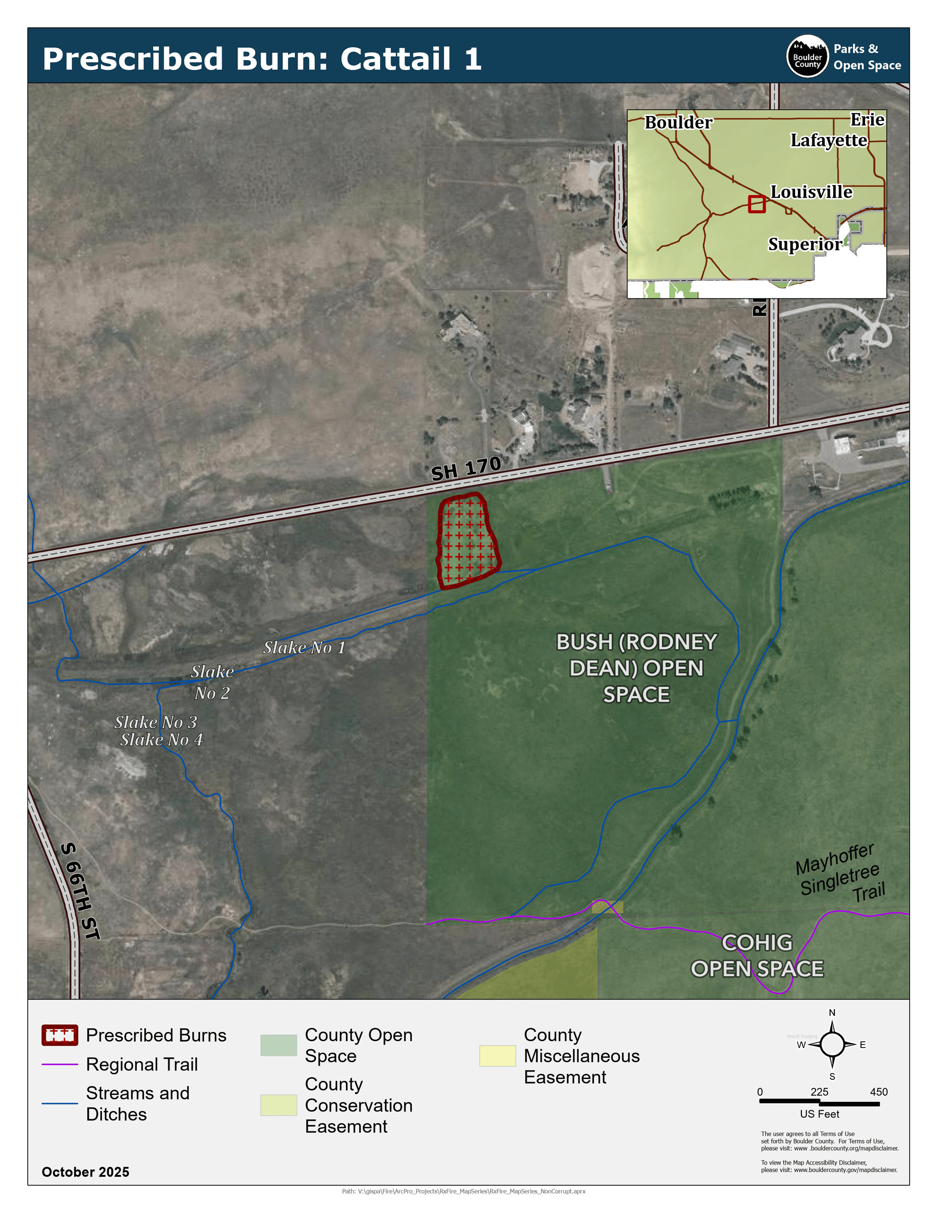