Boulder County Fireshed
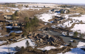
Calwood fire burn area

Boulder County Fireshed

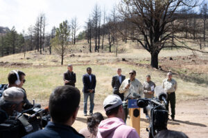
U.S. Fire Service Chief Moore speaks at Heil Ranch Open Space

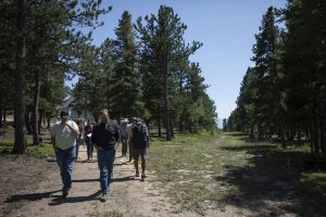
USFS Chief Moore speaks as Interior Secretary Haaland, Senators Bennett and Hickenlooper, Congressperson Neguse, and Regional Forester Beum listen at Heil Ranch Open Space, announcing new federal forest health mitigation money on April 11, 2022. Part of Heil Ranch burned in the 10,000-acre Calwood Fire in 2021, the largest Boulder County Fire in terms of acres burned. Mitigation work by the Parks and Open Space Department at Heil Ranch significantly reduced tree mortality in the areas that were treated. Photo credit: U.S. Department of Agriculture

What is a Fireshed?

A Fireshed is a large area where social and ecological concerns about wildfire combine and intertwine. Bigger fires require bigger landscape area thinking. Wildfire increasingly operates at a large scale that connects the high country with downstream communities and resources. Fire indiscriminately crosses property boundaries, requiring collaboration by land owners and managers to address challenges. Because of these aspects, and in order to take steps to be adapted to wildfire, we need to think and act at the scale of a wildfire.

Why Have a Boulder County Fireshed?

Boulder County is ranked among the top 10 most-at-risk areas from wildfire in the USDA Forest Service’s Rocky Mountain Region. Since 1989, wildfires in the county have claimed 1,346 homes and structures, burned nearly 32,000 acres, and threatened the lives and property of thousands of residents. Residents of Boulder County are also impacted by wildfires that cause air and water quality degradation as well as impacts to mountain recreation assets. While low intensity wildfires are a natural part of a healthy ecosystem, fire suppression over the last 100 years has led forests in many parts of Boulder County to have vegetation densities 10 to 100 times their natural state, leaving Boulder County’s residents, recreation areas, and natural resources vulnerable to catastrophic wildfire.

Houses burned in the Marshall FireWe also were reminded in terrifying fashion on December 30, 2021 that, under the right conditions, grasslands in the county can bring devastation to non-mountain residents, homes, and businesses, as the 6,026 acre Marshall Fire demonstrated. That day 1,084 homes and seven businesses were destroyed and many more structures damaged. There was also at least one life lost.

Rebuilding lives, homes, and businesses on this scale will take years and require ongoing focus by governments, businesses, non-profits, and residents. In addition, minimizing the risk of such a tragedy repeating itself also needs to be carefully considered. The members of the Boulder County Fireshed, discussed below, have substantial expertise to bring forward in this regard and are looking for ways to assist governments and policy makers.

Wildfire Risk Maps

Boulder County Fireshed In the News

Boulder County Fireshed Agreement

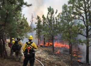
Firefighters monitor a prescribed burn at Heil Valley Ranch south of Lyons in 2020.

Firefighters monitor a prescribed burn at Heil Valley Ranch south of Lyons in 2020.

In August of 2020, federal, state, and local governments joined with non-profit entities in Boulder County to establish the Boulder County Fireshed as a shared vision for reducing the risk of wildfire to its people, communities, recreation areas, and natural resources through closely coordinated forest management across all lands.

With the signing of the agreement (boco.org/ForestMOU), the USDA Forest Service and Boulder County have identified a shared vision for the future of Boulder County forest and wildfire mitigation management together with Colorado Parks and Wildlife, Colorado State Forest Service, the City of Longmont, the City of Boulder, the communities of Nederland, Gold Hill, and Lyons, the Boulder County Firefighters Association, the Longmont Conservation District, the Boulder Valley Conservation District, and Colorado Forest Restoration Institute at Colorado State University.

Boulder County Fireshed Vision Summary

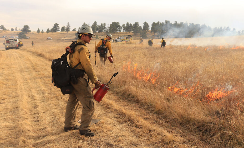
Firefighters monitor a prescribed burn at Hall Ranch Open Space near Lyons in 2021.

Firefighters monitor a prescribed burn at Hall Ranch Open Space near Lyons in 2021.

  • Engage stakeholders located in the forest and downstream in meaningful and ongoing ways;
  • Establish a regional network of resilient forests better able to absorb and recover from current and future natural disturbances;
  • Collaboratively develop and support both wildland and prescribed fire management strategies so that wildfires are safely and effectively extinguished when and where needed and, in the right circumstances, more flexibly managed to reduce future risks;
  • Foster resilient forest ecosystems that support water quality and quantity needs, habitat for robust and healthy flora and fauna, and abundant recreation opportunities;
  • Actively manage the forest to enhance its health and reduce wildfire risk based on the best available data and contemporary science, including the use of climate science to understand how a changing climate will impact forests; and,
  • Promote the personal responsibility of residents who live in high-risk areas to plan and prepare for wildfire.

A key part of this effort calls for local non-profit collaborative groups to assist with its implementation. The Left Hand Watershed Center, the St. Vrain Forest Health Partnership, and the Boulder Watershed Collective are ramping up their efforts with the public, scientists, and the MOU signatories to refine the shared vision going forward and identify mutual priority actions that meet the vision and goals of the agreement.


Boulder County commissioners on a wildfire mitigation tour

Boulder County Commissioner Matt Jones (left) and Gold Hill Fire Protection District representative Chris Dirolf walk the Sacred Mountain Ashram property to see the wildfire mitigation steps taken on a tour of Boulder County Fireshed areas on Friday, August 20, 2021, in Boulder County. (Photo by Timothy Hurst/Boulder Daily Camera)

Boulder County Fireshed Participating Organizations:

Boulder County Fireshed Main Contact

Paul Orbuch, porbuch@gmail.com

Boulder County Wildfire Partners Contact

Jim Webster, jbwebster@bouldercounty.org

Contact Us

Mailing Address

Community Planning & Permitting
Forest Health
PO Box 471
Boulder, CO 80306

Property Owner and
Private Land Issues

wildfiremitigation@bouldercounty.gov
Community Planning & Permitting
2045 13th St.
Boulder, CO 80302
Map and Directions

County Managed
Open Space Lands

bcforestry@bouldercounty.gov

Community Forestry Sort Yards

Email Wayne Harrington, Sort Yard Operator:
wharrington@bouldercounty.gov
Parks & Open Space
303-678-6368
Website: Community Forestry Sort Yards website