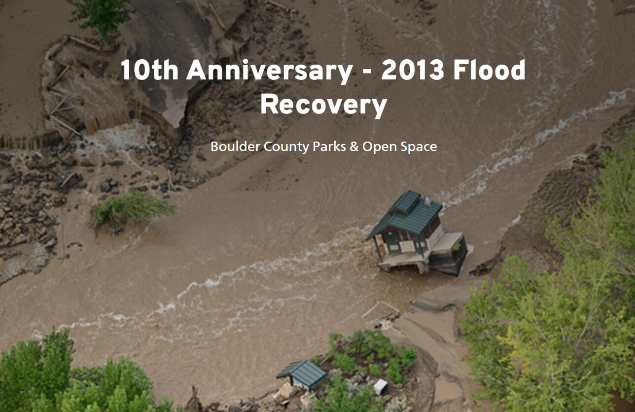
The 2013 Flood caused massive damage to parks and open areas. Work has been completed along all of the major creeks in Boulder County and at nearly all park and trail facilities.
Open Space Flood Recovery Projects
Rebuilt, Repaired, and More Resilient
In addition to repair of parks and trails, some significant improvements were made to many of the reservoirs and ditches to improve their resilience to future potential flooding. About $20 million dollars in recovery work was funded by Federal Emergency Management Agency (FEMA) will additional support provided by Great Outdoors Colorado and others. And more than $15 million in support was provided by the National Resource Conservation Service, U.S. Department of Housing and Urban Development, and the U.S. Army Corps of Engineers.
Funds were leveraged to not only restore facilities to their pre-flood condition but also to increase resiliency to future flooding, enhance habitat for native species, and reshape landscapes to better align with the open space values for which they have been preserved.
Interactive StoryMap
The 10th Anniversary – 2013 Flood Recovery StoryMap is an interactive webpage that tells the story of recovery work done by Parks & Open Space.
Major Parks and Trails Projects
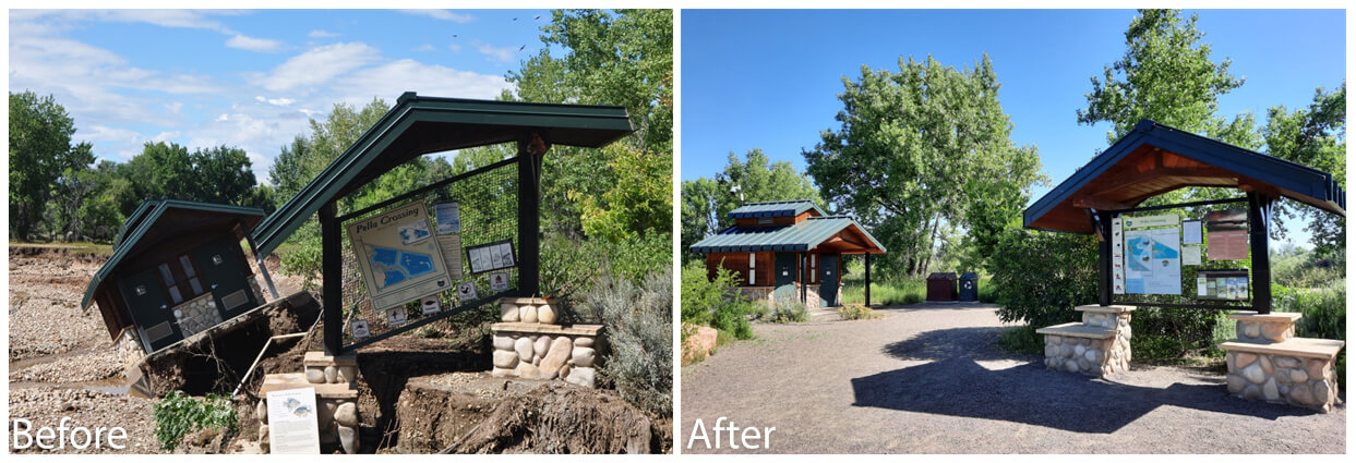
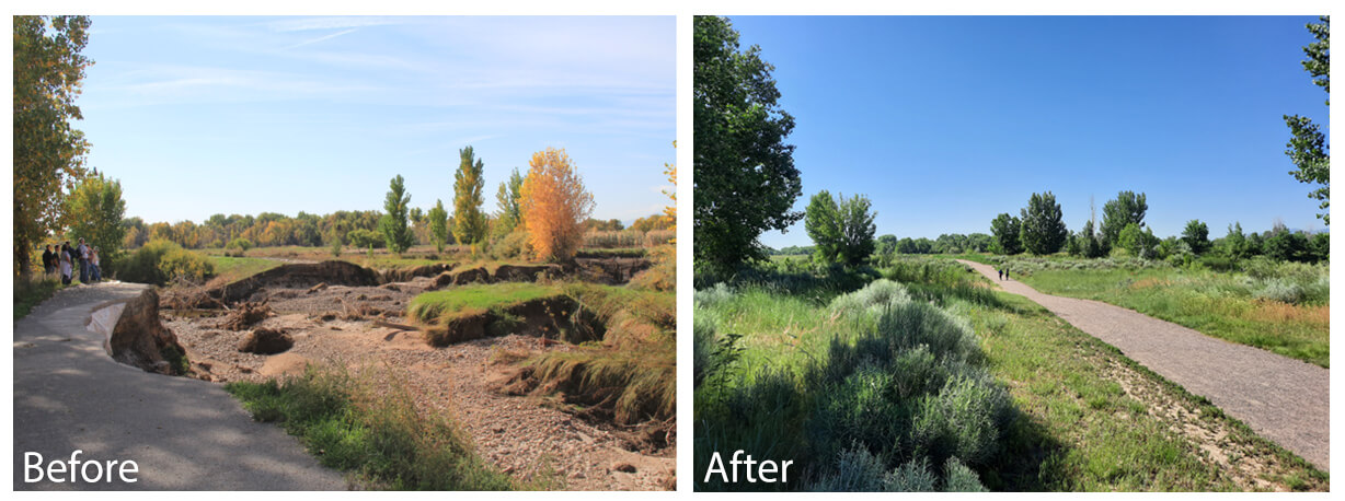
Pella Crossing
Reconstruction projects included repairing the breaches between the ponds, creating new wetlands, rebuilding the trails, and restoring the trailhead.
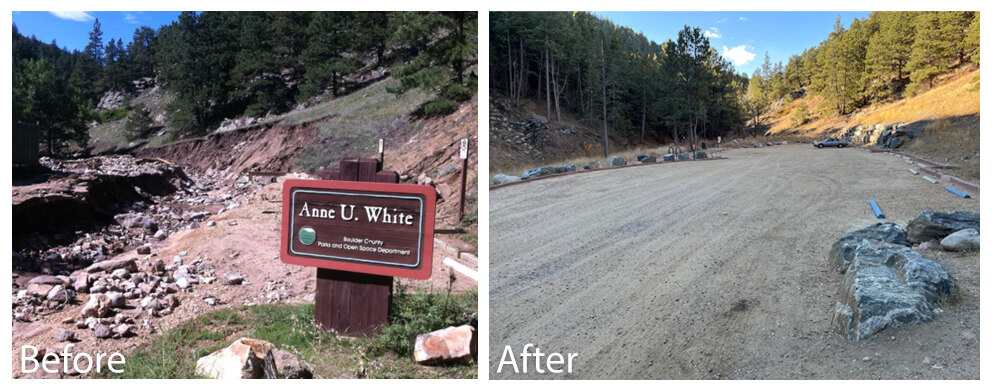
Anne U. White Trail
The trail was restored and the parking lot was rebuilt to accommodate more visitors.
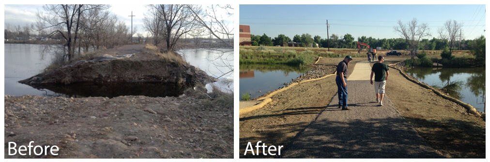
Walden Ponds Wildlife Habitat
The trails were restored and the two pond breeches (one between Cottonwood Marsh and Wally Toevs Pond and the other between Cottonwood Marsh and Bass Pond) were repaired. Structured spillways, or “low water crossings,” were built along with ADA compliant connecting trails.
Major Stream and Pond Projects
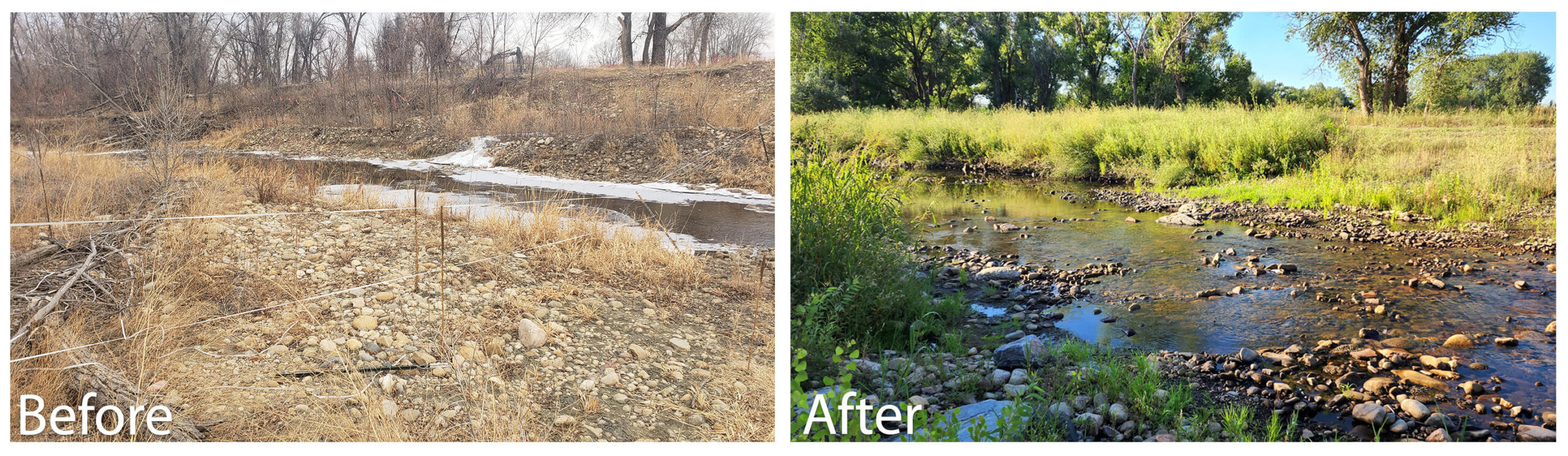
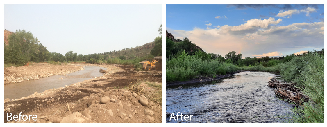
St. Vrain Creek
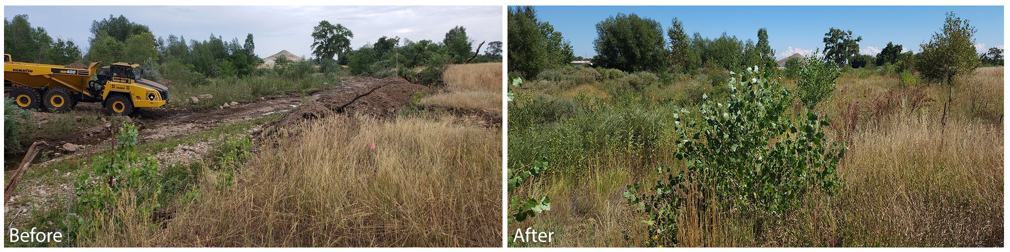
The St. Vrain Creek was restored, graded, and the channel was shaped to minimize future erosion. Over 41,000 willows, shrubs, trees, and wetland plants were planted to restore the nearly 1 mile riparian corridor. The project improved aquatic and riparian habitat while protecting infrastructure through enhanced floodplain connections and directing excess stream flow into improved main channel riffle and pool features. The diversion structure was made more robust through the use of buried sheet pile and the removal of a small dam to enhance sediment and fish passage.
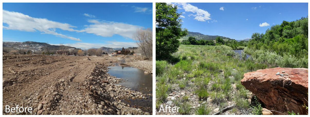
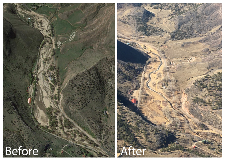
South St. Vrain Creek (Hall Meadows)
The South St. Vrain Creek along Hwy 7 was restored and the channel was improved. Over 35,000 cubic yards of sediment was removed, six overflow channels were constructed to slow and spread flood water, nearly 20,000 plants were planted along the nearly 1.5 miles of stream. The floodplain now provides a safe, natural, resilient, functioning, and ecologically rich habitat utilizing natural system principles. The area is more resilient to future flood events.
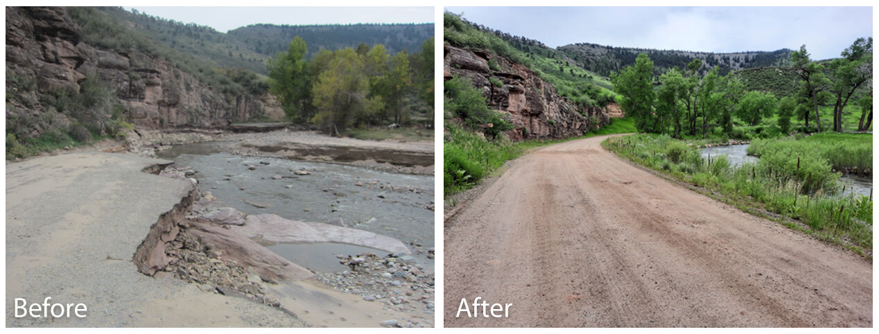
Hall 2 Access Road
Repair of the access road began on March 26, 2018, and was completed on June 1, 2018. A section of the South St. Vrain Creek was also moved back to its pre-flood location. Mitigation measures were also incorporated to minimize flood-caused erosion in future flood events. The riparian area’s vital ecosystem functions were sustained through the incorporation of natural channel design elements, all while minimizing the project’s overall footprint. This approach complemented the goals of other flood recovery projects along the creek.
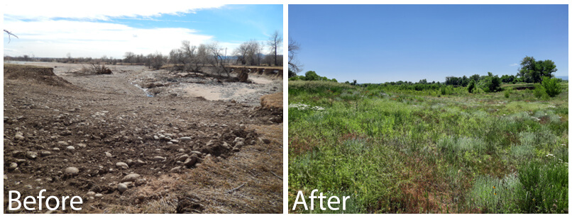
Lake 4, West Lake, and A-Frame Pond
The project included the repair of four breached earthen embankments and three lakes/reservoirs on Western Mobile, Braly, and Ramey open space properties. Water storage was restored and delivery function of Lake 4 and the pre-flood configuration of the other reservoirs. The project improved the resilience of the reservoirs and the surrounding landscape by providing a more defined and controlled flood path. More than 220,000 cubic yards of sediment was removed from Lake 4 and repurposed as fill.
Left Hand Creek Restoration at Brewbaker-Sorensson
Creek restoration work was completed along Left Hand Creek on the Brewbaker-Sorensson property. The project restored the creek using a natural channel design approach. Restoration of the stream channel reconnected the stream with its floodplain and altered the channel morphology through adjustments of stream pattern, dimension, and profile. This was achieved by lowering the width-to-depth ratio of the stream; placement of in-stream bank stabilization and habitat structures, large wood and boulders; and restoring riffles and pool features. The design also included modifications to the bed and bank. Stream banks were stabilized using bio-engineering techniques like willow staking and large wood placement.
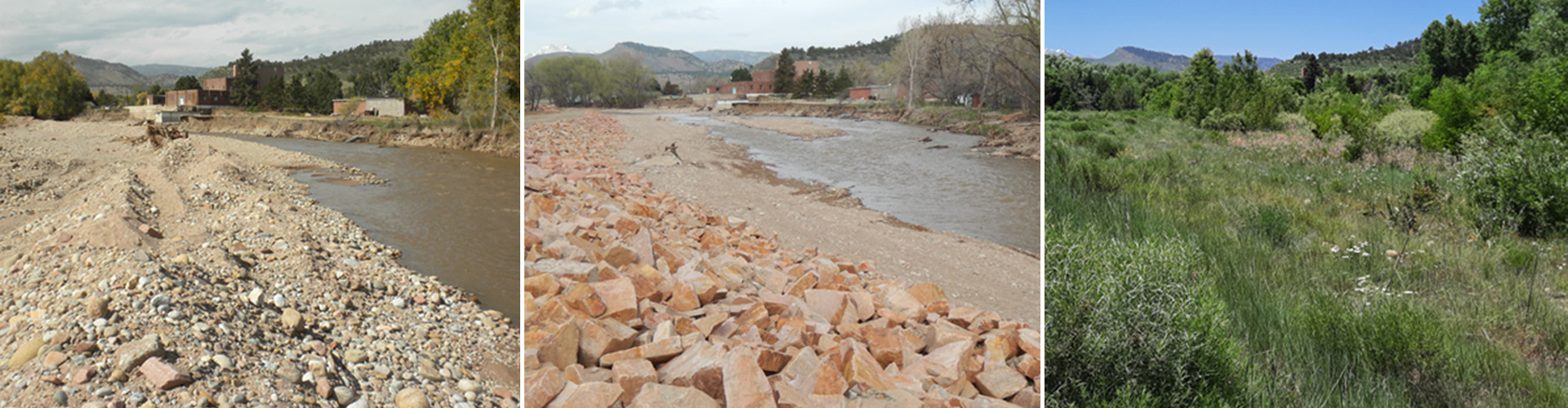
Niwot Ditch Diversion Repair and Fish Passage
The project replaced the existing diversion dam with an engineered structure approximately 400 feet upstream of the existing dam location that includes two headgates. Using design concepts from natural channel design, the new diversion dam is a multi-objective structure built from natural materials that is more resilient to high flows, reduces flood risk, allows passage of native and non-native fish, and facilitates natural stream processes and function.