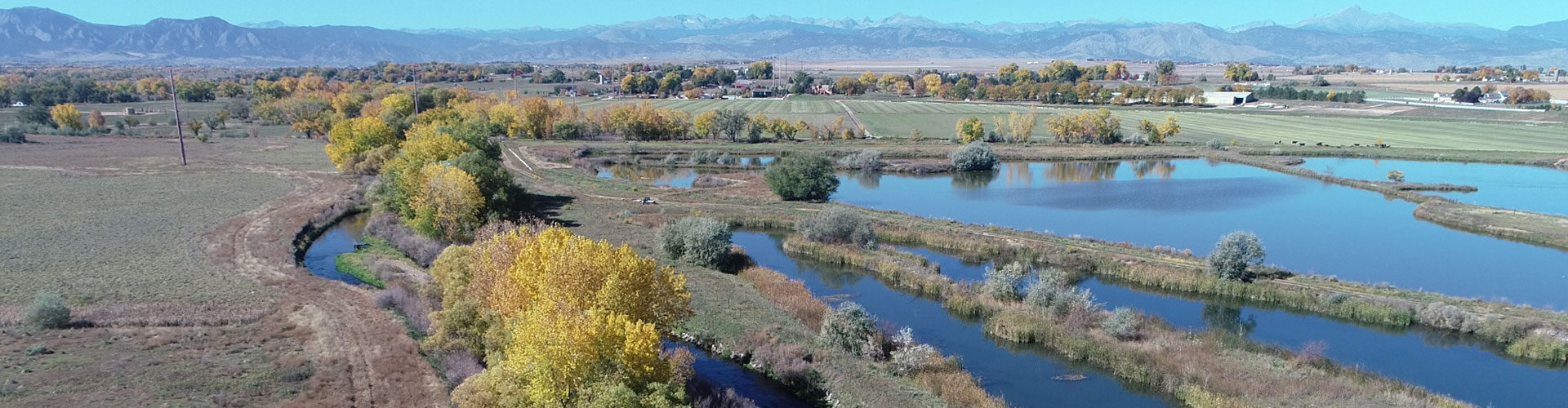
Prairie Run, located along East Boulder Creek, is a new open space park in the making. With restored stream corridors, wildlife habitat, and sweeping Front Range views, the park will offer a variety of recreational opportunities while also respecting the important natural features. Once complete, visitors can enjoy trails, picnics, family gatherings, and quiet moments by the water.
Prairie Run Open Space
Phase I: Southwest Section
Phase I construction began Oct. 6, 2025, on the southwest section of the planning area. Construction is expected to be complete by early fall of 2026.
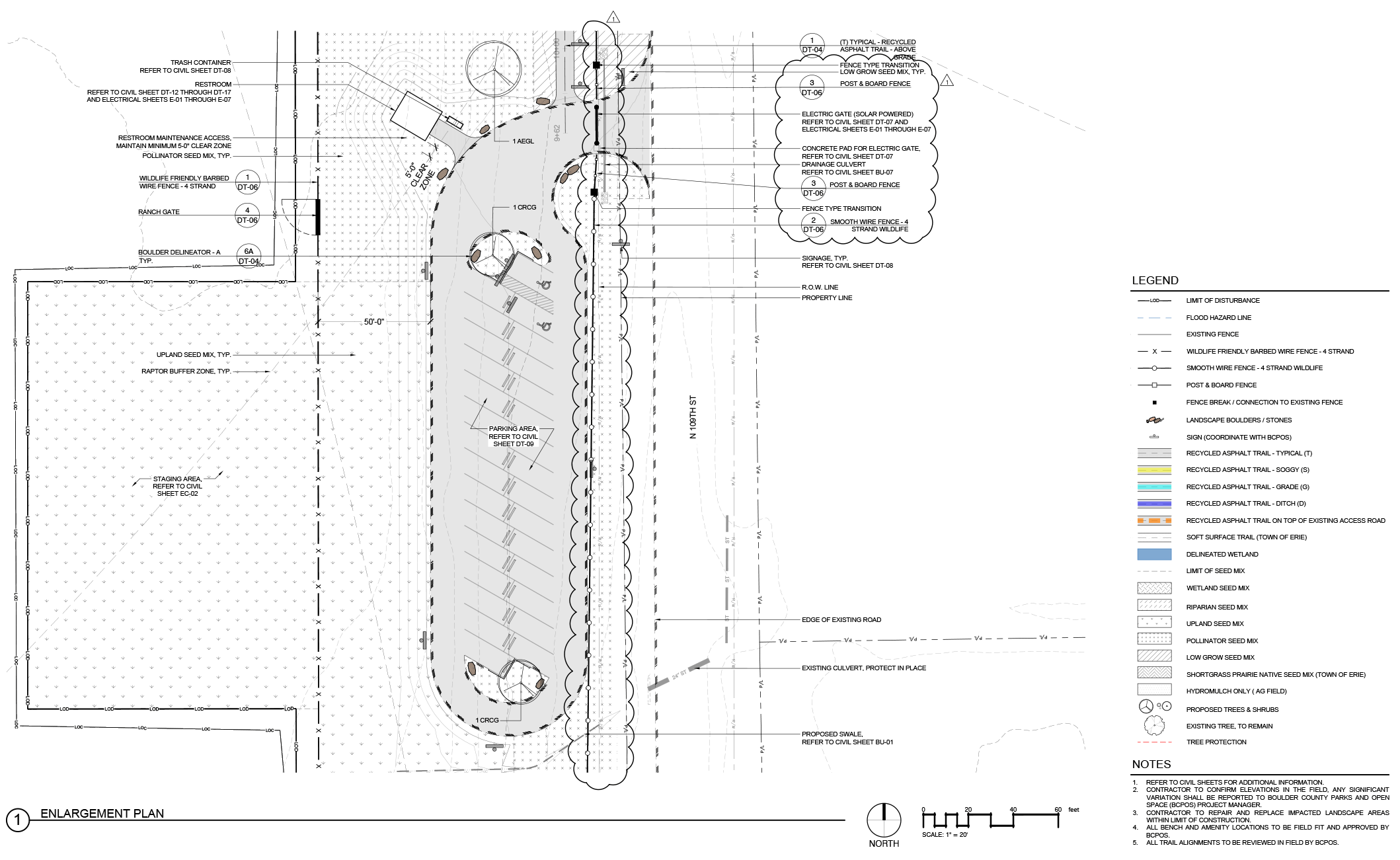
The southwest area will include a new 2-mile trail and a trailhead.
Sun Stride Trail
- A soft-surface trail, approximately 2 miles long.
- Access point to the Boulder Creek.
- Connections to the Town of Erie and future connections to the Boulder to Erie Regional Trail (BERT).
- A flashing crosswalk at 119th Street between Kenosha Road and Jasper Road.
- A shade structure.
- Multiple benches along the trail.
- Dogs will not be allowed due to wildlife sensitivities as stated in the management plan.
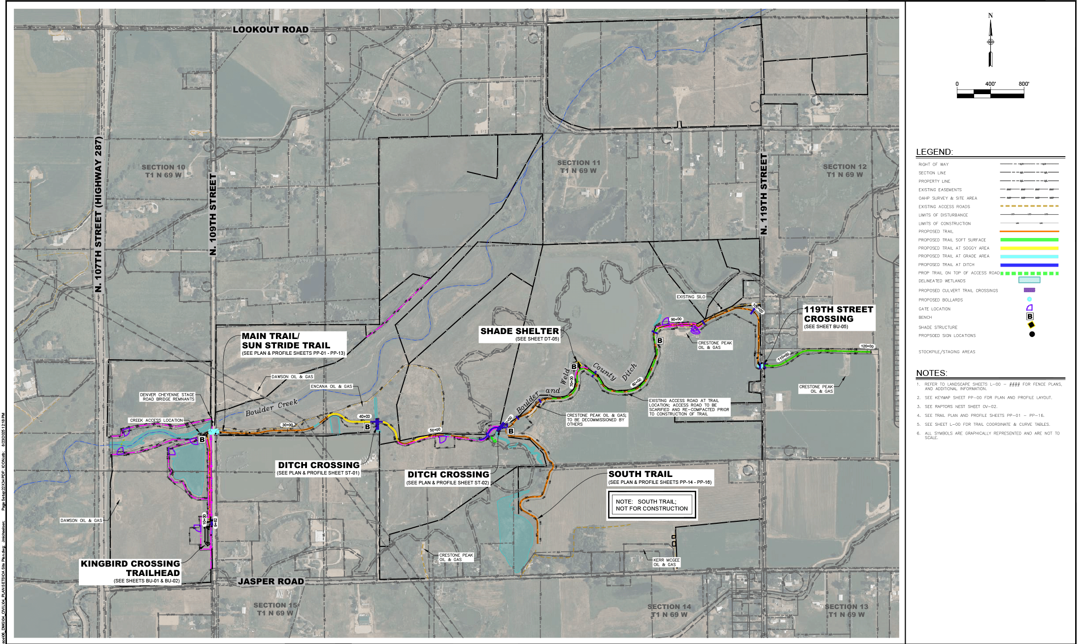
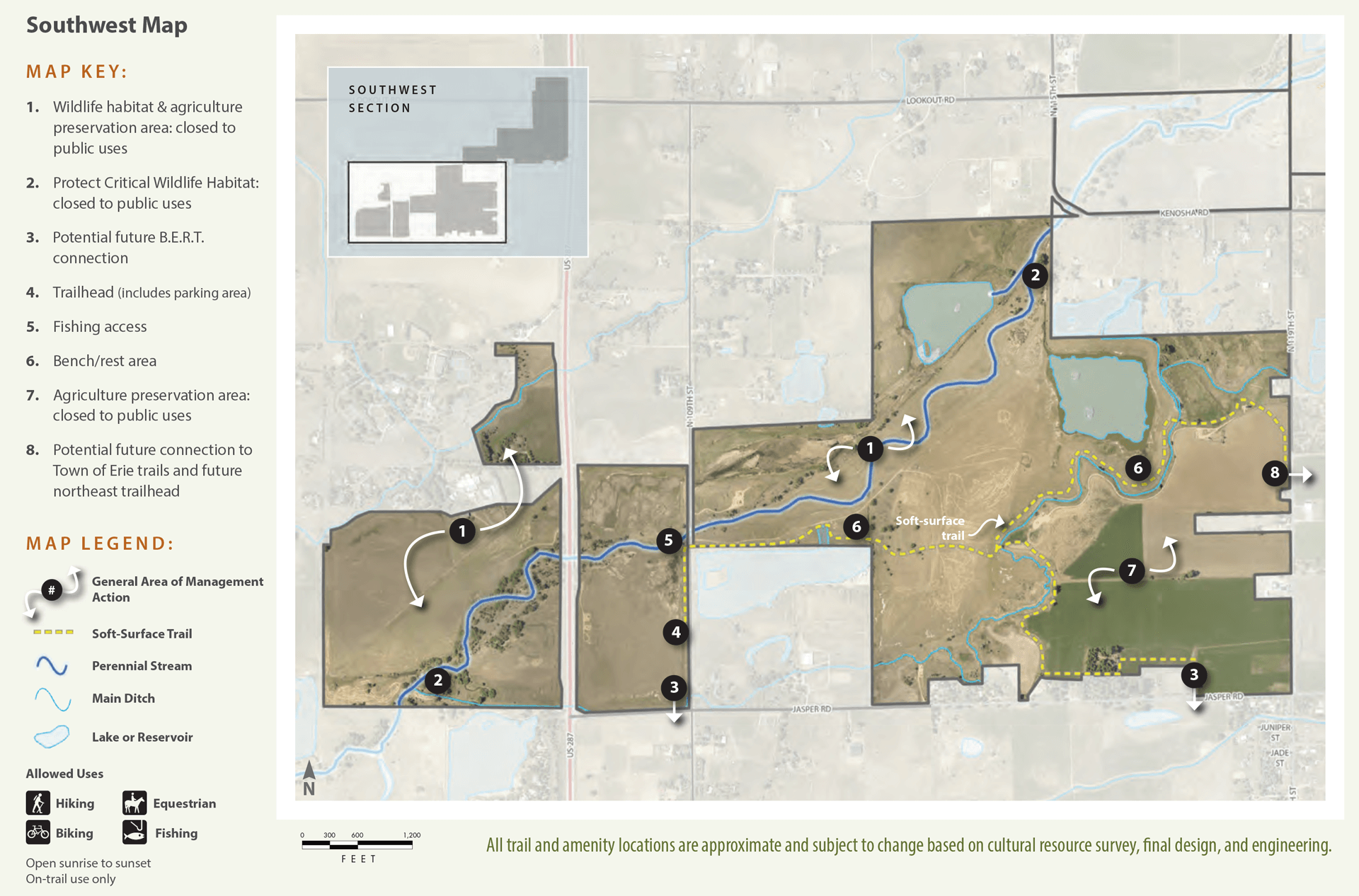
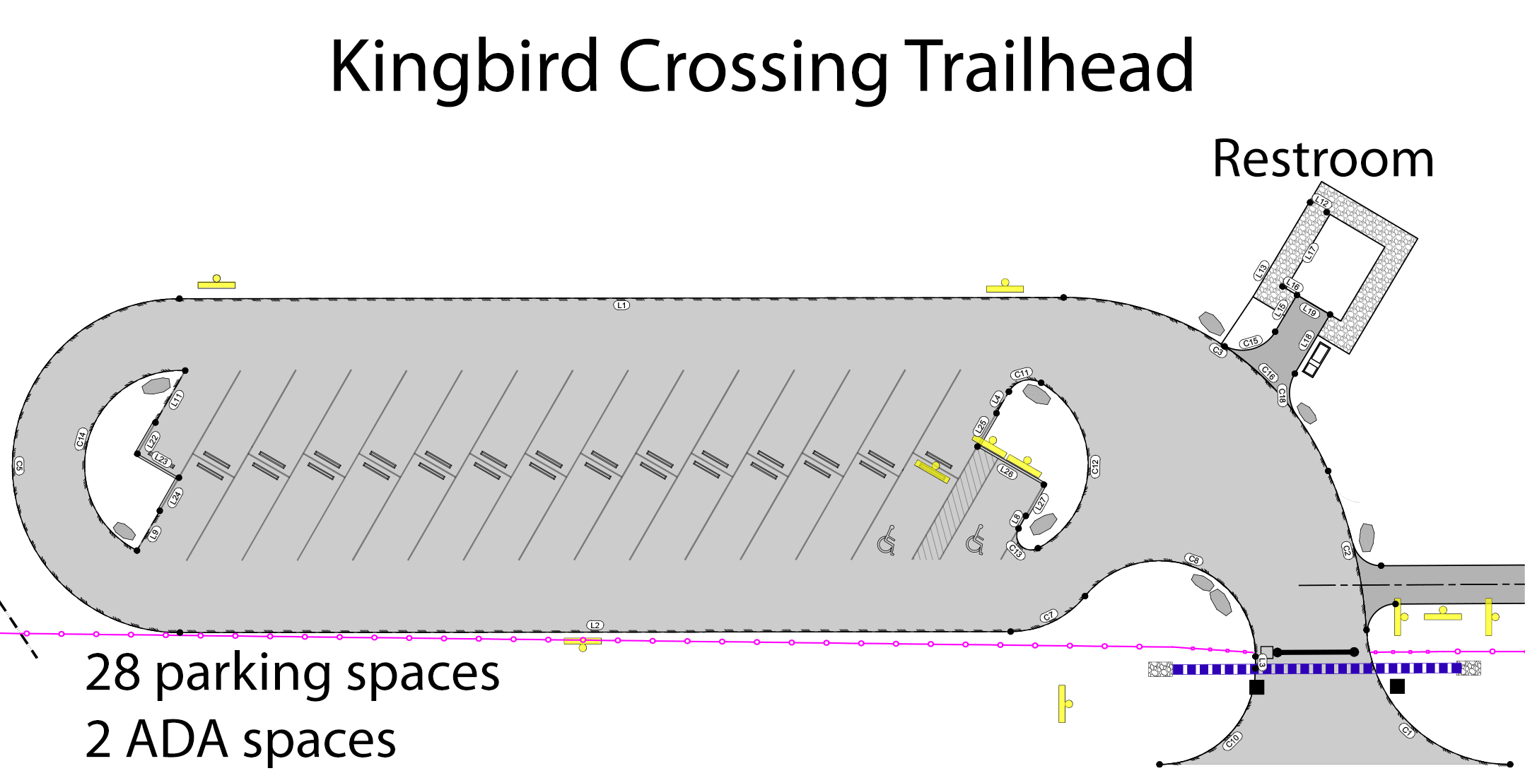
Kingbird Crossing Trailhead
- Located on N. 109th Street just north of Jasper Road.
- 30 parking spots including 2 ADA spots.
- Accessible restroom.
- An electric access gate that will open and shut each day to prevent parking after hours.
Phase II: Northeast Section
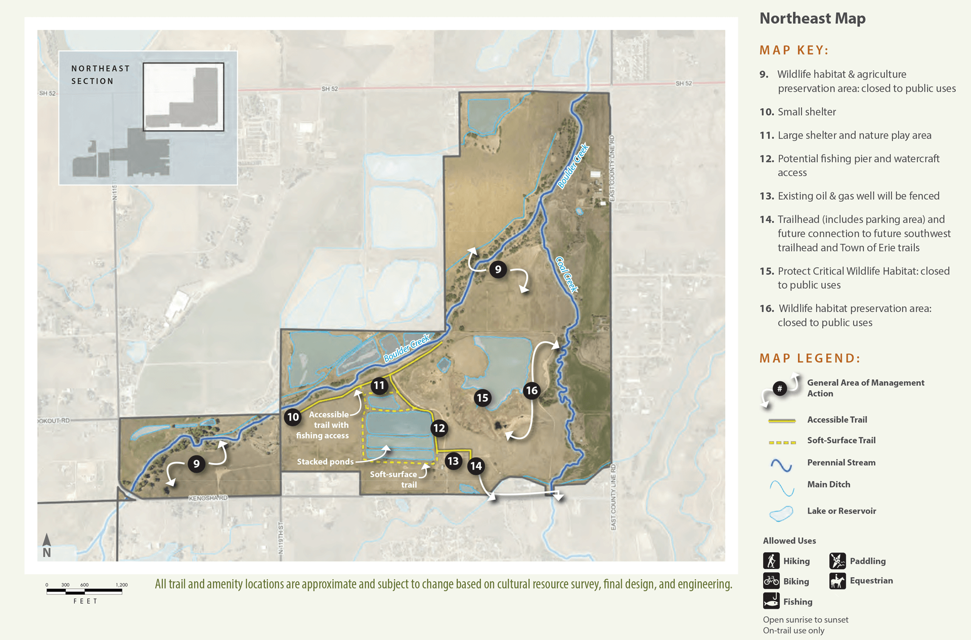
Phase II will focus on the northeast section of the planning area. Due to the complex site conditions, the restoration and infrastructure work will require several years for permitting, engineering, and construction before it is completed.
The northeast area will include:
- A trailhead with a maximum of 65 parking spaces, 3 ADA spaces, 6 horse trailer spaces, and room for a school bus.
- A restroom.
- A small shelter and a large shelter.
- A nature play area.
- Soft-surface trails.
- Picnic tables and benches.
- Access to fishing.
Design work is underway for the trailhead, trail, and park amenities, with completion expected in early 2026. Stream restoration designs for Boulder Creek and Coal Creek are also in progress and anticipated to be finished in mid to late 2026.
On March 28, 2024, the Board of County Commissioners voted 2-0 to pass the East Boulder Creek Site Management Plan for Prairie Run Open Space. The plan will guide the management of the section of the Boulder Creek Valley at the confluence of Coal Creek. The plan was crafted after receiving extensive public feedback during the first phases of the planning process. The plan embodies the department’s dual mission of conservation values and people priorities.
The plan includes the following amendments:
- No dogs allowed on Prairie Run Open Space.
- Remove soft-surface trails north of Kenosha Pond Critical Wildlife Habitat and east of Coal Creek, including eliminating the bridge crossing Coal Creek.
- Amend language regarding regulatory signage to ensure inclusive language.
- Amend language regarding work with indigenous communities.
- From: “The department will reach out to Native American and Indigenous communities to build relationships and understand if there is an interest in co-creating an opportunity on East Boulder Creek.”
- To: “The department will collaborate with Native and Indigenous Communities. The department has engaged with Tribal Leaders and Native Americans about potential activities and uses at places on EBC. The plan supports a continuation of that work.”
- Proceed with parking access on 109th with a maximum of 30 spaces. Staff will continue conversations and negotiate with the Town of Erie to develop an Intergovernmental Agreement (IGA) for future parking opportunities on Erie’s open space. At this time, proceed with parking access on the southwest side of Prairie Run Open Space; trailhead and parking lot to be located off 109th Street and have a maximum of 30 parking spaces. If an IGA with Erie is reached before construction of this referenced trailhead parking infrastructure, staff must bring the management plan back to BOCC to reconsider the size of parking on 109th Street.
- May 2025 Update: Boulder County and the Town of Erie have concluded discussions on a potential parking lot on the Erie Wise Homestead property to serve Prairie Run. Both parties agreed on a potential location; however, the necessary property acquisitions and further public engagement will require more than two years of coordination before an IGA could be established. For this reason, the county is moving forward with the 109th Street lot.
Land Management
Reflecting the conservation and stewardship component, the plan includes:
- Protection of wildlife habitat.
- Continuation of sustainable agriculture.
- Restoration of wetlands and stream corridors associated with Boulder Creek and Coal Creek.
Recreation
Addressing the community requests for recreation, the plan proposes a variety of recreational opportunities while also respecting the important natural features of the site. The public facilities will include:
- Water access.
- An accessible trail to Boulder Creek.
- Two trailheads with restrooms and parking lots.
- Over five miles of trails that will facilitate connections to the existing network in Erie including the Coal Creek Regional Trail and the future Boulder to Erie Regional Trail.
Implementation
Design and permitting work has begun. The goal is to have some of the site open to the public in 2025 to coincide with the 50th anniversary of Parks & Open Space. The rest of the site will open between 2028–2030 to allow time for appropriate federal, state, and local permitting and construction
The management plan was approved after an extensive public input process. Public engagement reports can be found in Appendix B. Boulder County appreciates the community members who provided comments to the community surveys and at the public engagement events. Staff used that input to develop the plan. Management actions that directly reflect community input are indicated in the plan.
Public Meetings
Board of County Commissioners Public Hearing
March 28, 2024
Boulder County Courthouse, 1325 Pearl St, 3rd Floor, Boulder
The Board of County Commissioners held a public hearing and approved the plan with amendments.
Watch the March 28, 2024 meeting
Board of County Commissioners Public Hearing
Jan. 25, 2024
Boulder County Courthouse, 1325 Pearl St, 3rd Floor, Boulder
The Board of County Commissioners reviewed the plan and listened to public feedback. An additional public hearing was scheduled for March 28.
Watch the Jan. 25, 2024 meeting
Jan. 25, 2024
Boulder County Courthouse, 1325 Pearl St, 3rd Floor, Boulder
The Board of County Commissioners reviewed the plan and listened to public feedback. An additional public hearing was scheduled for March 28.
Watch the Jan. 25, 2024 meeting
Open House
Jan. 18, 2024
Staff were available to answer questions about the plan and provide additional information about possible locations being considered for the southwest trailhead.
Jan. 18, 2024 Open House Handout
Jan. 18, 2024
Staff were available to answer questions about the plan and provide additional information about possible locations being considered for the southwest trailhead.
Jan. 18, 2024 Open House Handout
Parks & Open Space Advisory Committee (POSAC)
Dec. 14, 2023
POSAC voted to recommend the plan to the Board of County Commissioners (BOCC) with the following conditions: 1) Staff will research the alternative locations for the 109th Street trailhead and 2) Staff will present the results of that analysis and make a recommendation to the BOCC at the Jan. 25 meeting.
Watch the Dec. 14, 2023 meeting
Onsite Neighborhood Meeting
Dec. 13, 2023
The meeting provided an opportunity for neighboring residents to learn more about the alternative trailhead locations considered during the planning process. Staff discussed the project, answered questions, and received input.
Dec. 13, 2023
The meeting provided an opportunity for neighboring residents to learn more about the alternative trailhead locations considered during the planning process. Staff discussed the project, answered questions, and received input.
Parks & Open Space Advisory Committee (POSAC)
Nov. 16, 2023
POSAC met for a second review of the plan, listened to public feedback, and decided another meeting was needed before they could vote on their recommendation of the plan.
Watch the Nov. 16, 2023 meeting
Nov. 16, 2023
POSAC met for a second review of the plan, listened to public feedback, and decided another meeting was needed before they could vote on their recommendation of the plan.
Watch the Nov. 16, 2023 meeting
Parks & Open Space Advisory Committee (POSAC)
Oct. 26, 2023
POSAC was introduced to the plan, asked questions of staff, and listened to public feedback.
Watch the Oct. 26, 2023 meeting
Oct. 26, 2023
POSAC was introduced to the plan, asked questions of staff, and listened to public feedback.
Watch the Oct. 26, 2023 meeting
Neighborhood Survey
A letter was sent to neighbors residing within 1,500 feet of the site with instructions to take the trailhead location survey. The survey asked neighbors to identify their preferred and least preferred locations for the southwest trailhead and parking lot. The survey was open Jan. 8–21, 2024, and there were 105 responses.
Preferred Location
- Location A (Hwy 287): 36 (34.3%)
- Location B (109th St): 31 (29.5%)
- Location C (Jasper Rd): 18 (17.1%)
- Location D (N 119th St): 20 (19%)
Least Preferred Location
- Location A (Hwy 287): 31 (29.5%)
- Location B (109th St): 29 (27.6%)
- Location C (Jasper Rd): 17 (16.2%)
- Location D (N 119th St): 28 (26.7%)
Community Survey #3
Public comment on the draft plan was accepted from Oct. 11-29, 2023. There were 229 responses to the final survey. While not summarized into a formal report like previous survey efforts, the feedback provided by the public is shared in Appendix B starting on page 78. This feedback was taken into account when developing the report delivered to the Parks & Open Space Advisory Committee and the Boulder County Commissioners.
Community Survey #2
The second community survey was open from May 25 – July 31, 2023. The objective of the survey was to define the public’s priorities for conservation and community access, and collect any feedback on the future of the site.
The survey received 446 online responses to the survey and 543 individual responses from in-person events.
Survey participants indicated a high level of support for closing certain areas to protect critical wildlife habitat and agricultural operations. 60% of respondents strongly agreed with the potential closures.
When asked for additional comments related to the closure of the site, respondents who agreed with the closures identified conservation of the riparian area and the native wildlife as their primary concerns.
Respondents who felt negatively about the closures commented that the loss of public access to natural areas was not desirable. Respondents who felt neutral about the closures expressed that they would like to receive more information and that agricultural closures and conservation closures are separate issues.
When asked about outdoor experiences, the desired recreational activities identified by respondents included hiking, appreciating wildlife, walking, biking, and water activities.
Community Survey #1
The first survey was open from Nov. 17, 2022 through Feb. 28, 2023. The objective of the survey was to define the public’s priorities for conservation and community access and collect any feedback on the future of the site.
The survey received 1,041 responses.
Conservation Priorities
Survey participants said their top conservation values for the site are:
- Conserving wildlife habitat.
- Protecting land from development.
- Preserving ponds and flowing water.
- Protecting native trees, wildflowers, and grasses.
Conserving Wildlife Habitat
The site contains valuable wildlife habitat for bald eagles, red-tailed hawks, Swainson’s hawks, herons, coyotes, white-tailed deer, beavers, and more. We are proposing that some of the most sensitive areas be closed to visitors to protect wildlife.
Protecting Land From Development
The site was purchased with open space tax dollars. Thanks to your support, this land will not be developed into residential or commercial properties. We do not plan on developing campgrounds or allowing camping.
Preserving Ponds and Flowing Water
The site has 5 miles of the East Boulder Creek and Coal Creek tributaries. The creeks meet at a confluence in the northeastern part of the site. The ponds and wetlands are largely relics of mining activity that took place on the property and have increased habitat potential with additional restoration. We are planning to restore wetlands and an additional 3/4 miles of East Boulder Creek (learn more about the restoration work that has already taken place).
Protecting Native Trees, Wildflowers, and Grasses
Pockets of native trees, wildflowers, and grasses remain on the site and there is potential to restore native grasslands. Staff will work to increase native plant communities on the site for the benefit of habitat and agricultural production.
Visitor Experiences
Survey participants said the top outdoor experience/community access priorities they would seek out are:
- The opportunity for exercise.
- Finding respite and quiet reflection.
- Easy access to water.
- Let kids explore.
Opportunity For Exercise
We are planning several miles of soft-surface trail and will allow hiking, biking, dog walking, and horseback riding. Connections to the Town of Erie trails and the future Boulder-to-Erie Trail are also being planned.
Respite/Quite Reflection, Access to Water, and Let Kids Explore
We are considering several different infrastructure ideas so you can enjoy these opportunities.


Other Feedback
Site Name
Survey participants suggested the park be named for a natural feature found on the site or by Indigenous and Native American history. Some were in favor of keeping the current name — Boulder Creek/East Boulder Creek. Since natural features were the top theme, and this also honors indigenous history, the park will likely be named for a natural feature.
Tribal Involvement
Survey participants also advocated for tribal involvement in land management and future planning. We have several collaborative initiatives with indigenous communities. The Board of County Commissioners is the leader for government – to – government engagement efforts and Parks supports these conversations.
Other Comments
Survey participants raised concerns about private property access, traffic considerations, and hazardous materials like contaminated water sources. We will not encroach on private property, and all existing easements will be honored. Regulatory signage will be in place to direct visitors to public areas and fencing built where appropriate to protect private property. Traffic to the site will be managed primarily off Kenosha Rd. and 109th St. from Hwy 287. Parking lots will be adequately sized for anticipated visitation and offer trailer parking. We are currently researching gates for parking areas to prevent visitors from parking after hours. The area will be patrolled by rangers and supported by nearby emergency service agencies as needed. Staff will conduct water quality testing this summer to understand the feasibility of watercraft in ponds.
The site shares a border with Weld County at East County Line Road, and is also bounded by State Highway 52 on the north, US 287 generally on the west, and Jasper and Kenosha Roads on the south.
The Town of Erie lies just to the south, Niwot several miles to the northwest, and Longmont about five miles to the north.
This 1,377-acre site is composed of five individual open space properties that contain a dozen ponds and five miles of perennial stream along Boulder Creek and Coal Creek.
Indian Peaks reflection in Kenosha Ponds.
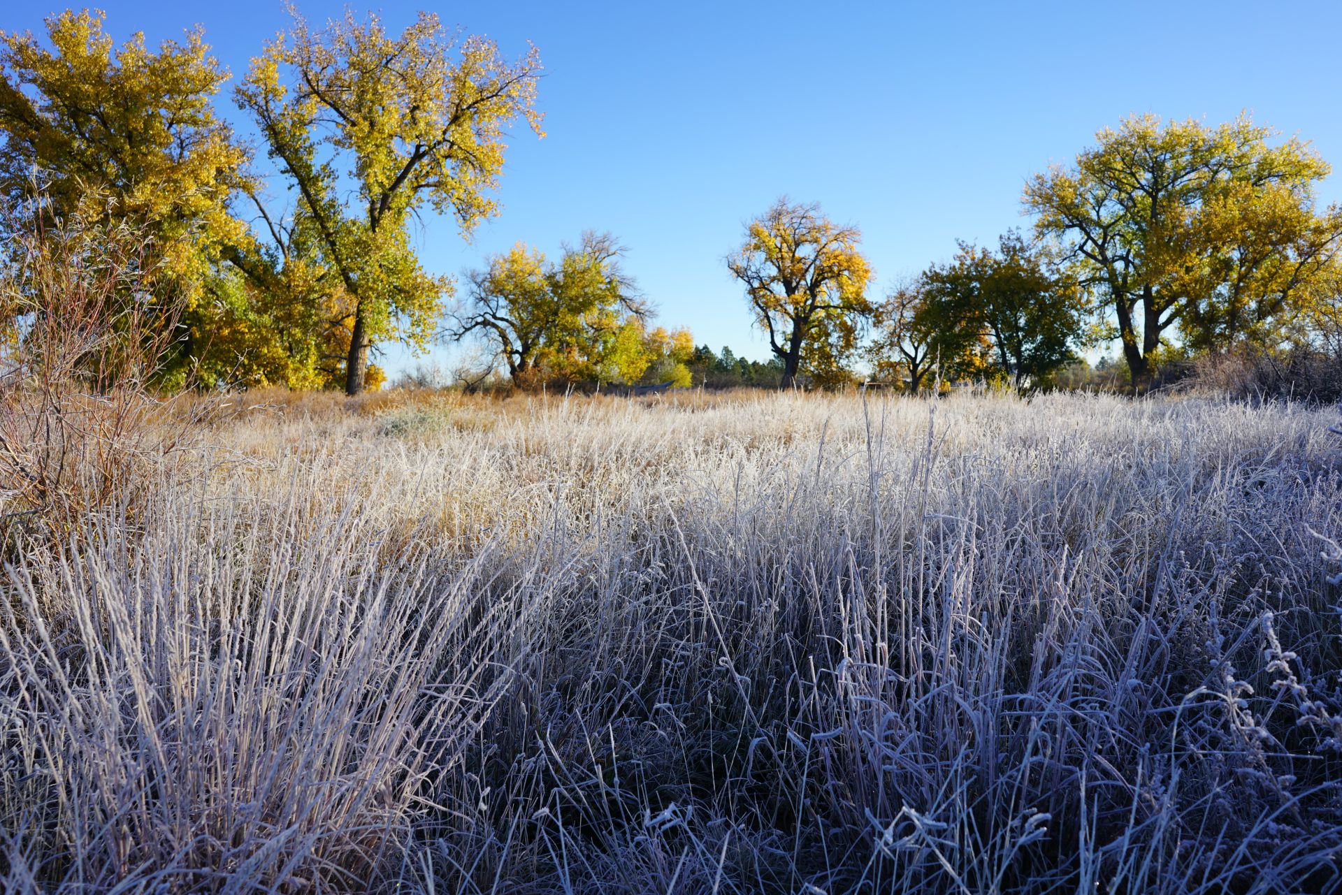
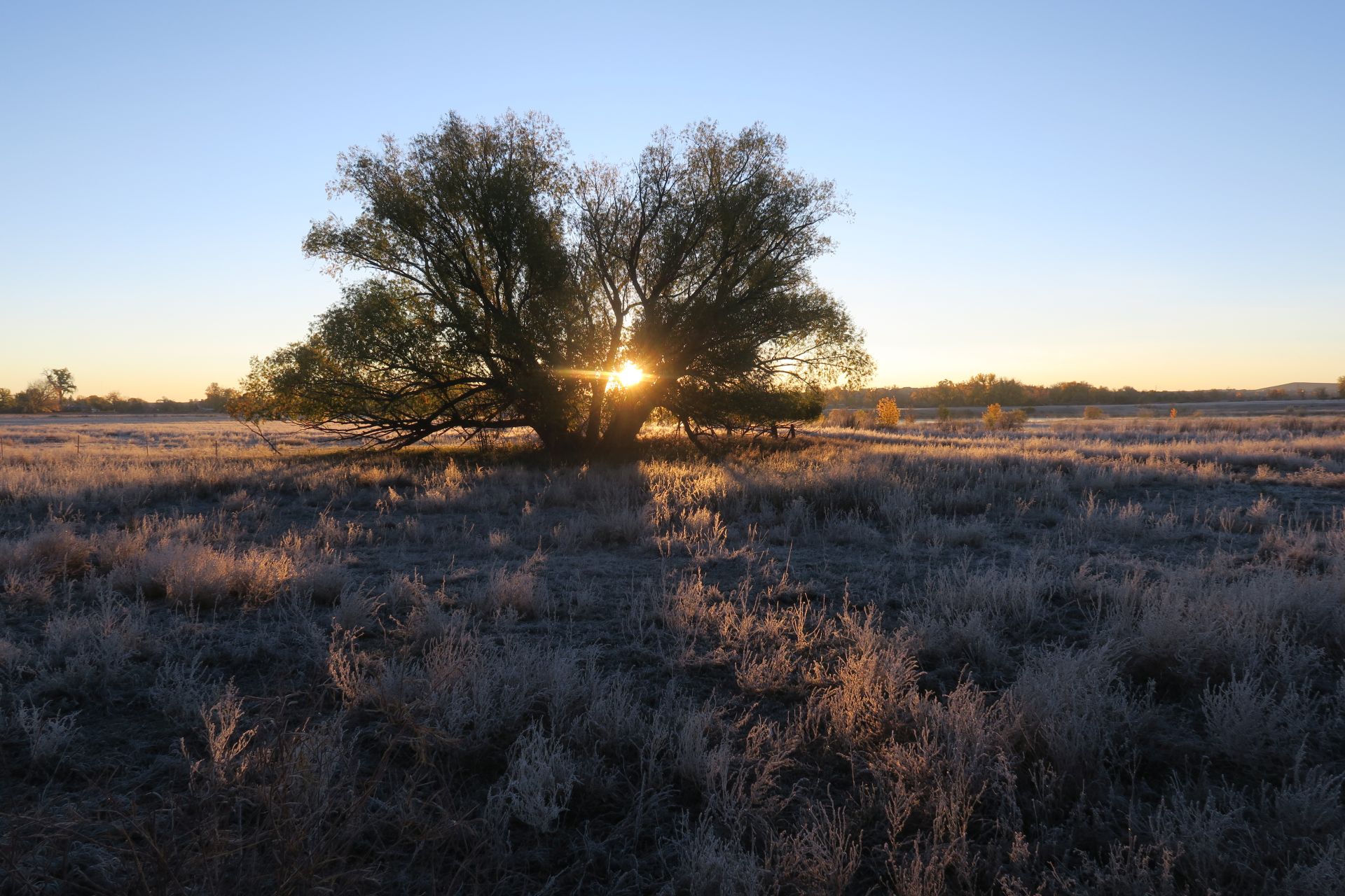
Frost on sideoats grama grass in a cottonwood grove along Coal Creek.
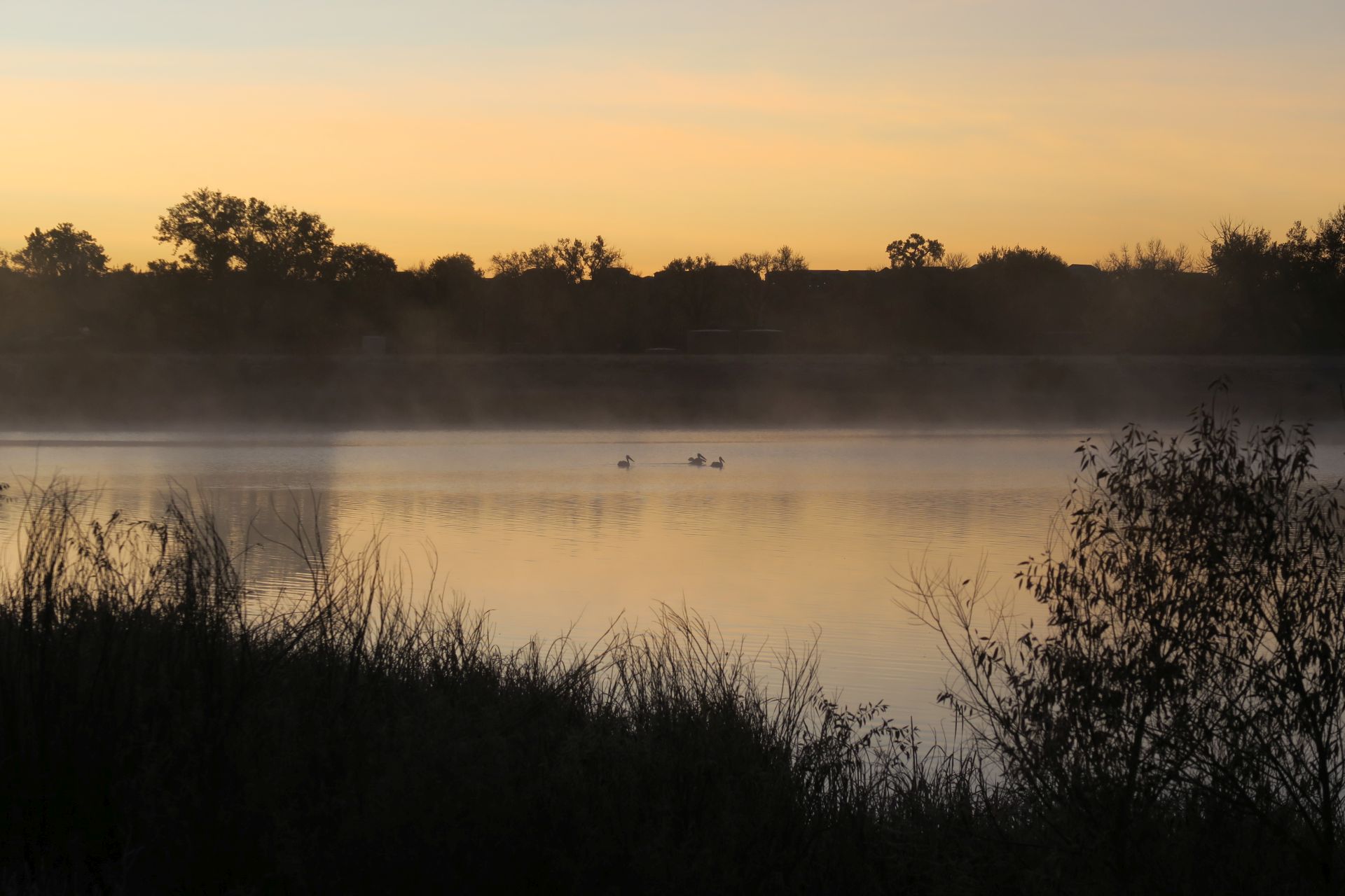
American white pelicans on Kenosha Pond.
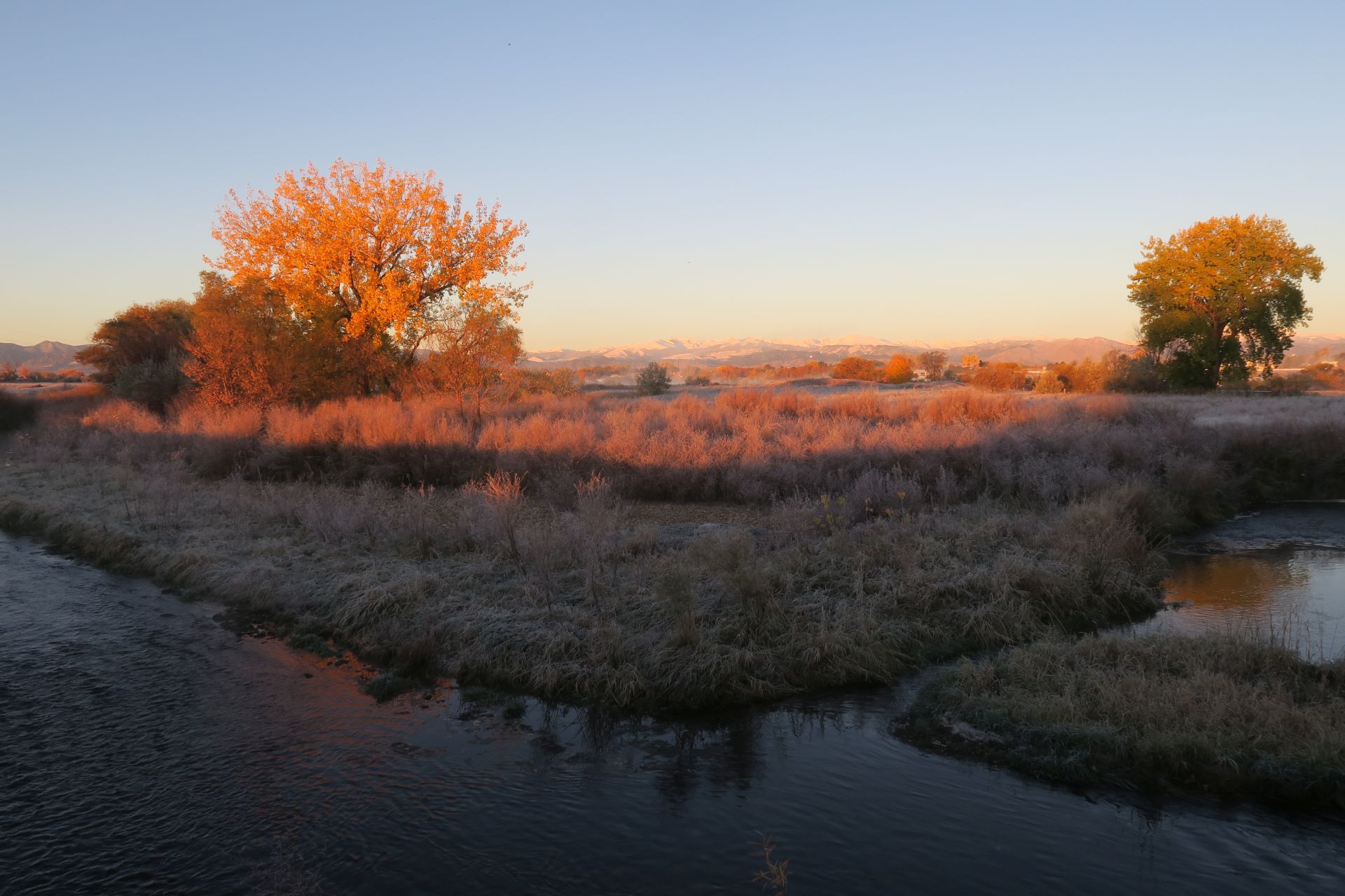
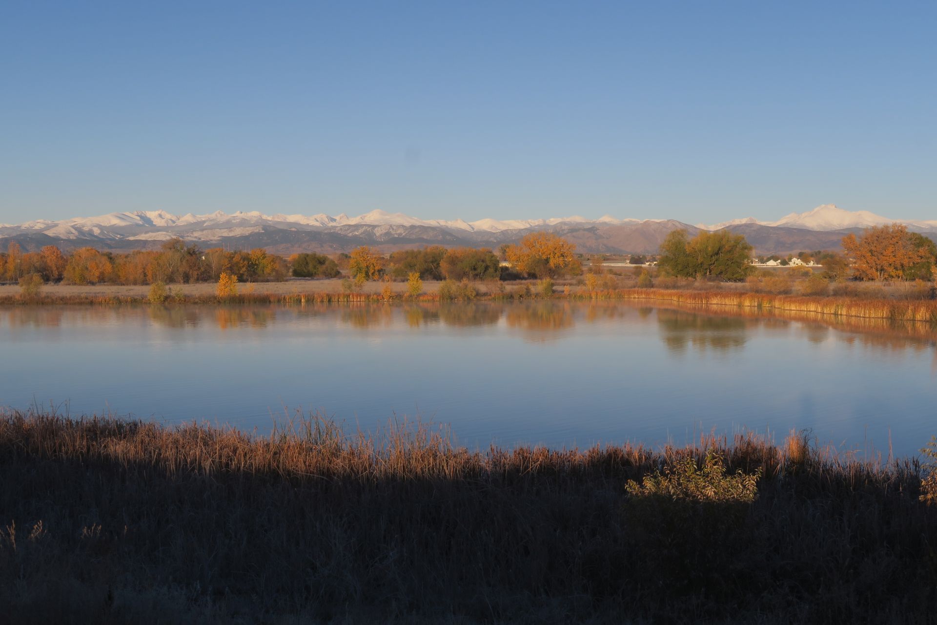
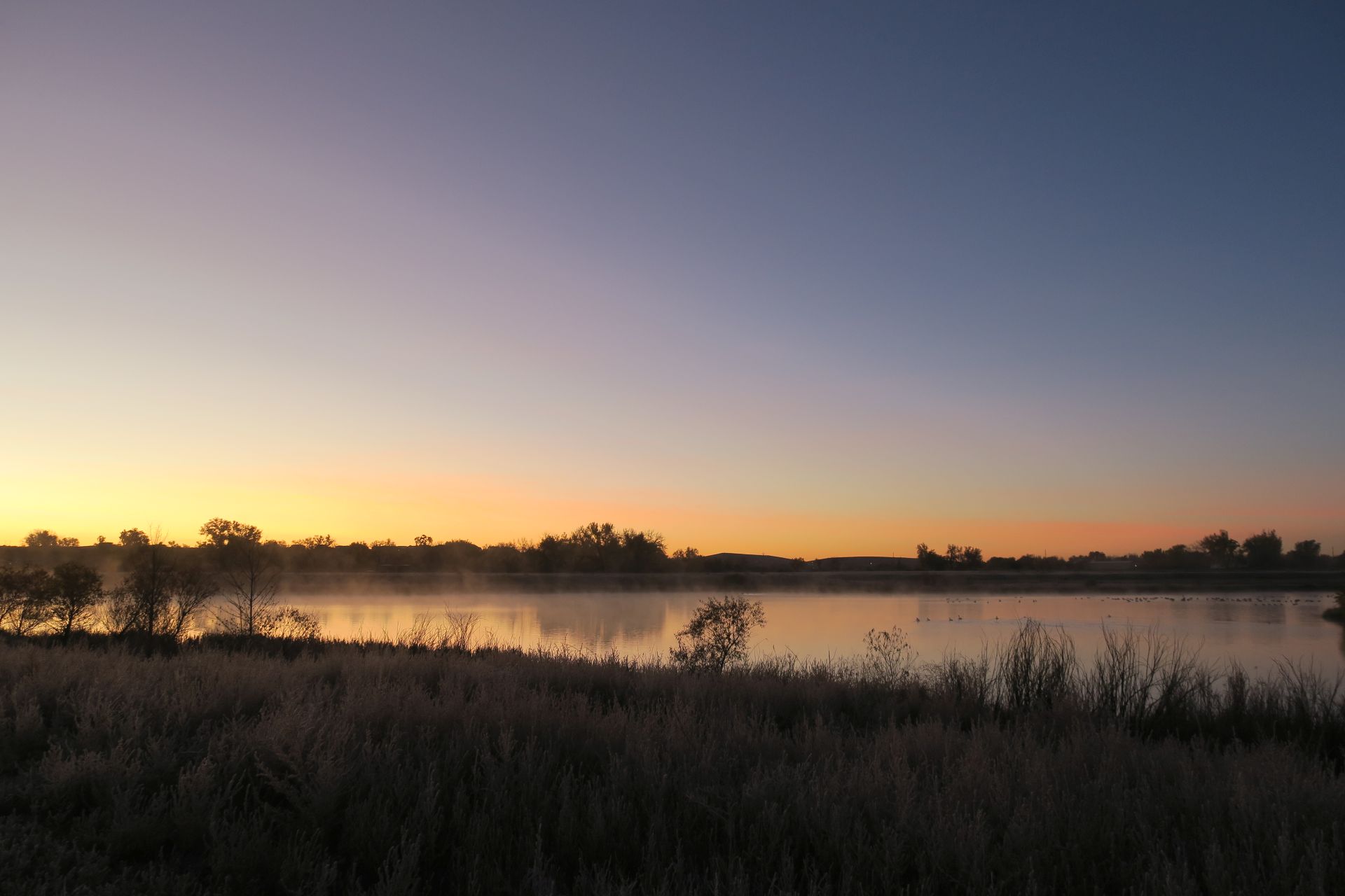
Sunrise along Boulder Creek looking west to the Indian Peaks.
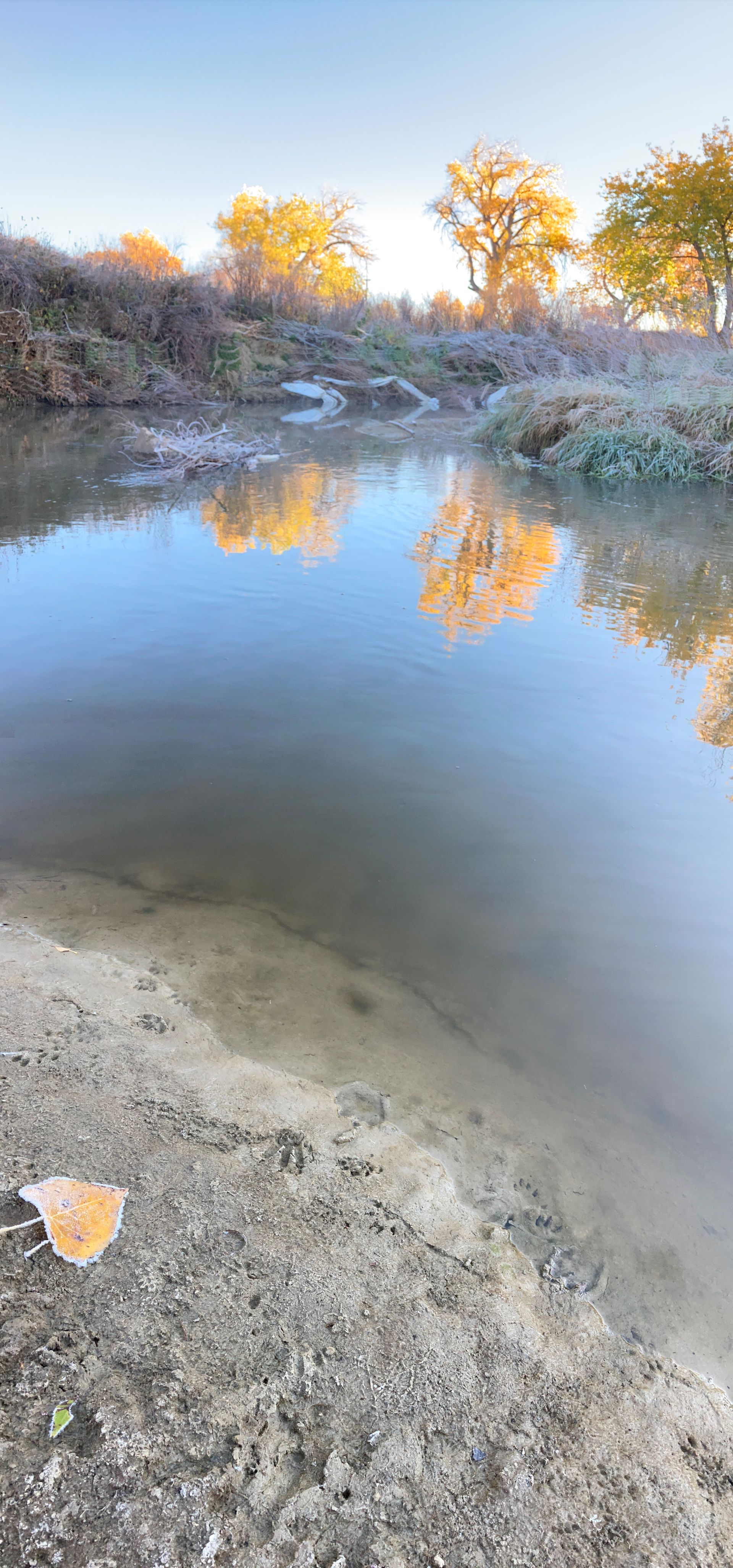
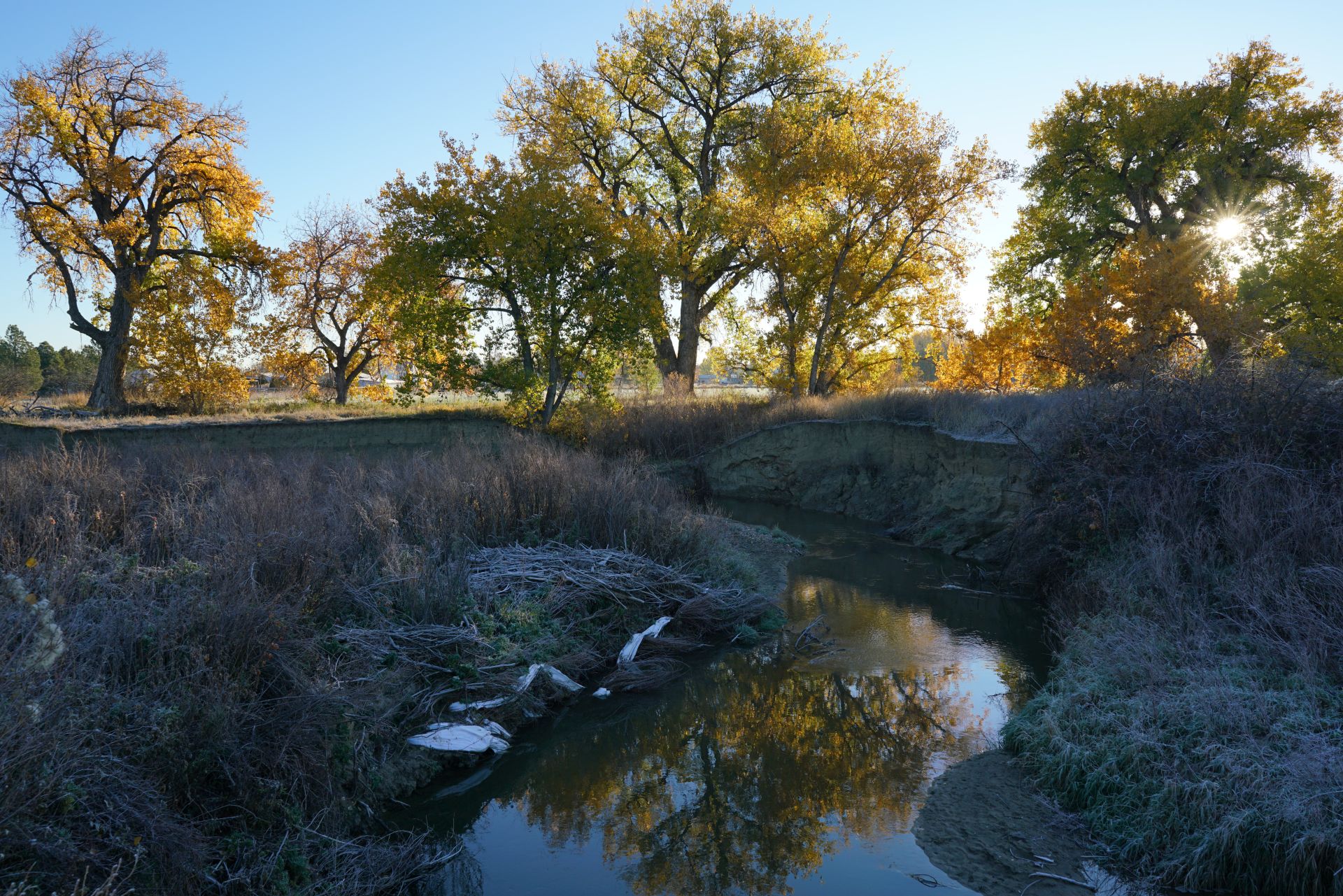
Animal tracks, frosty leaf, and some flood debris along Coal Creek.
Dawn on Kenosha Pond.
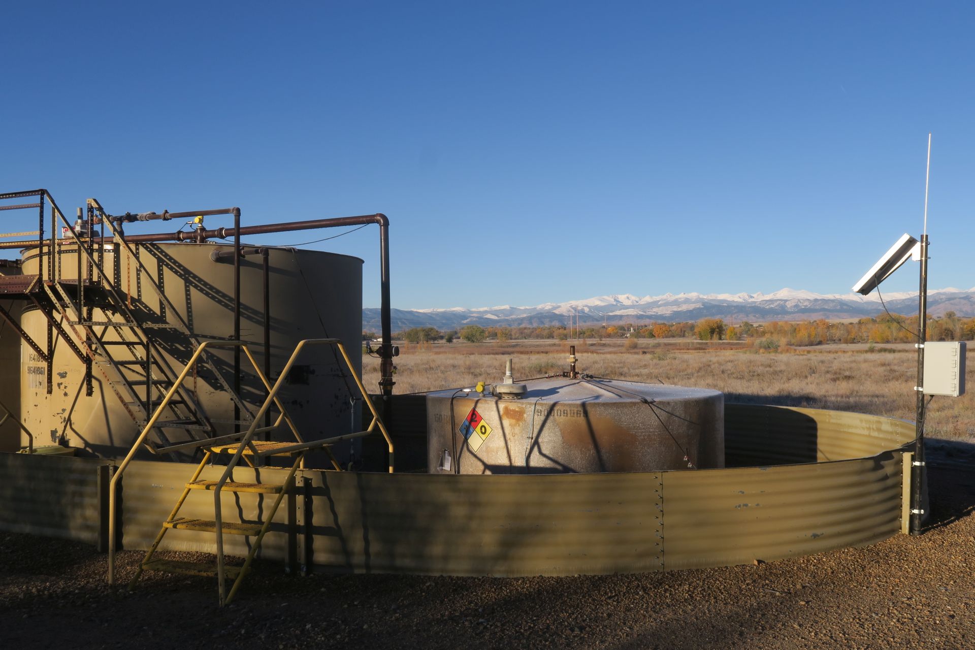
Views of Indian Peaks from oil and gas facilities.
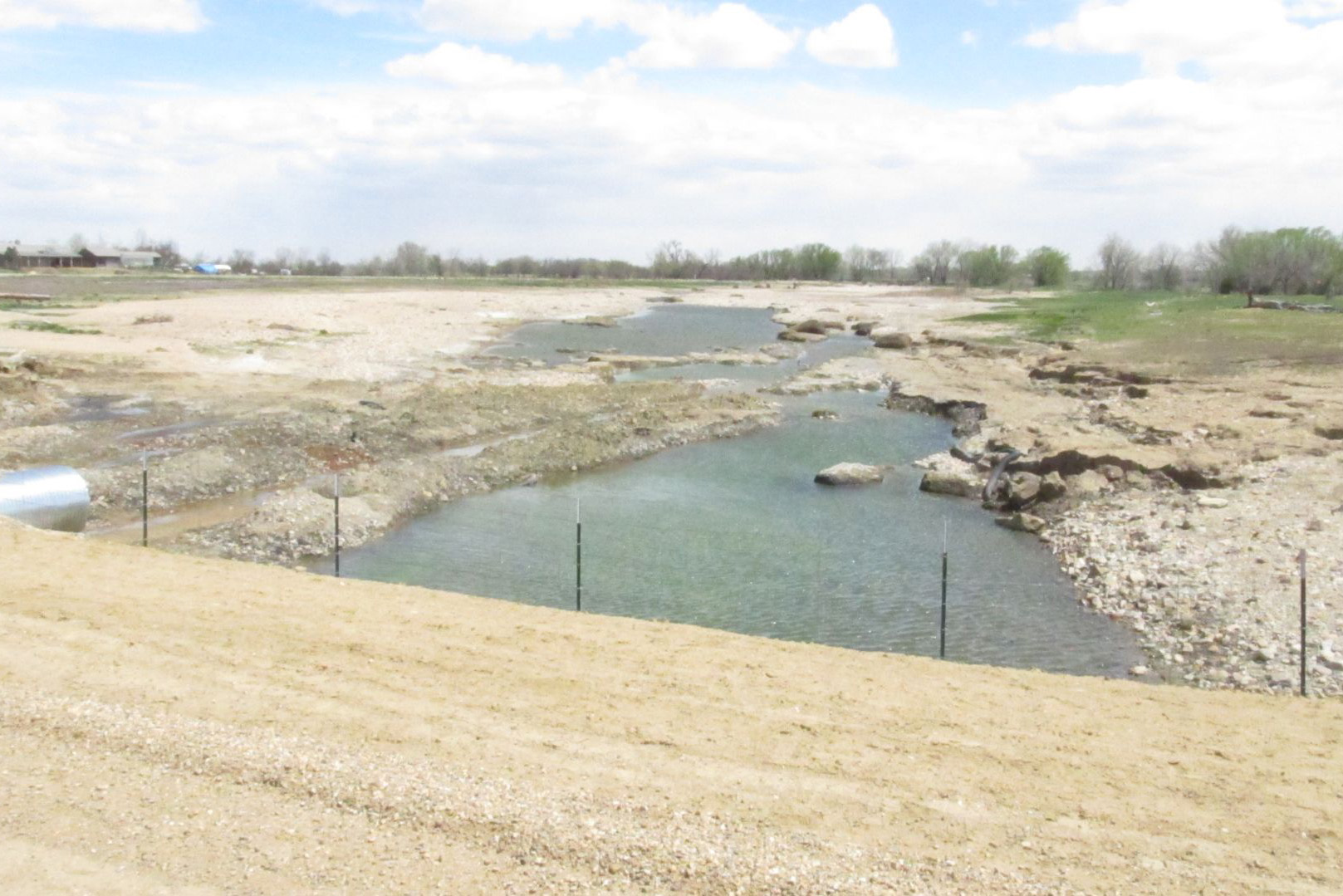
Boulder Creek flood damage just east of N. 109th St. near the Alexander Dawson property.
Riparian cottonwood grove along Coal Creek.
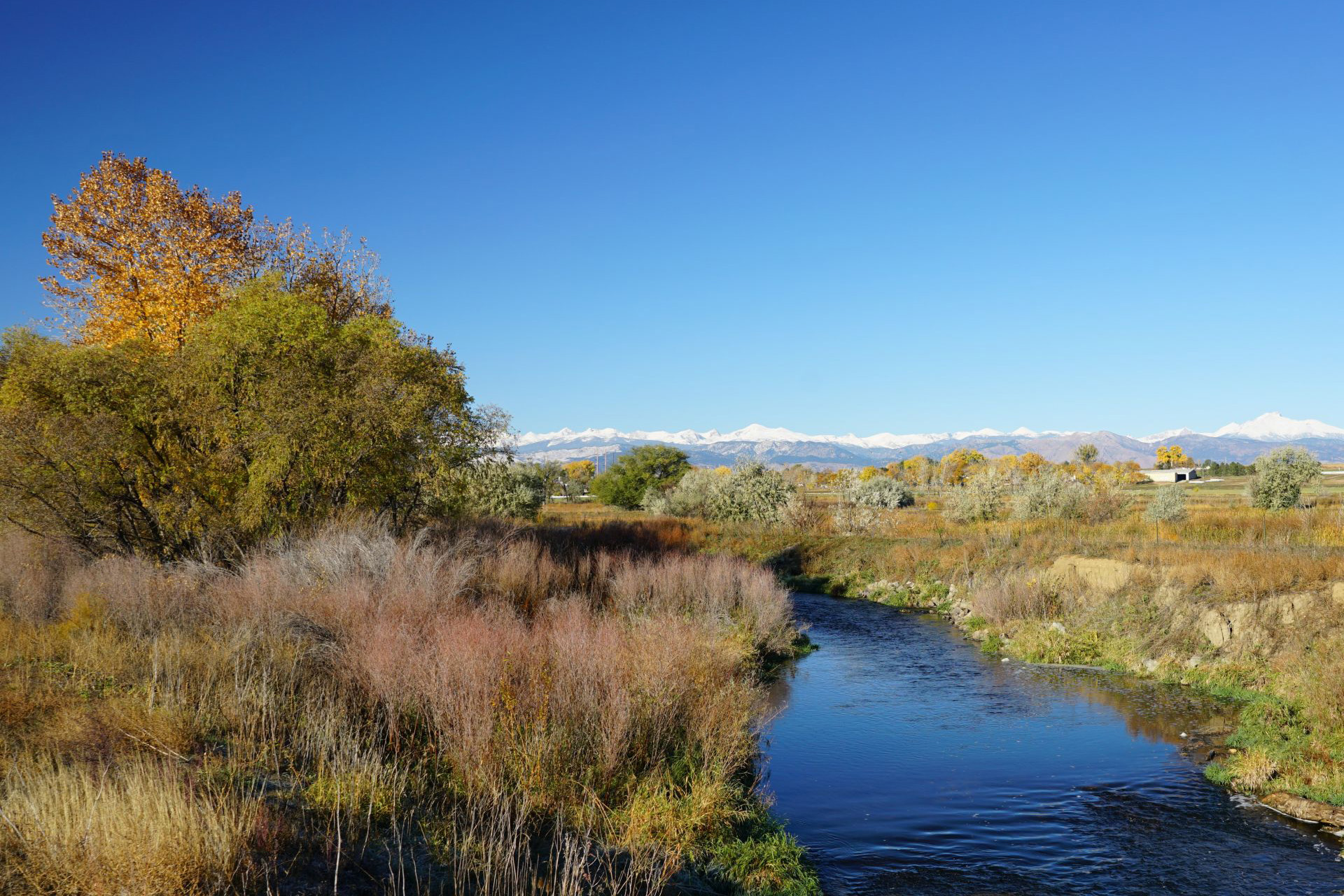
Boulder Creek on the East Boulder Creek Site.
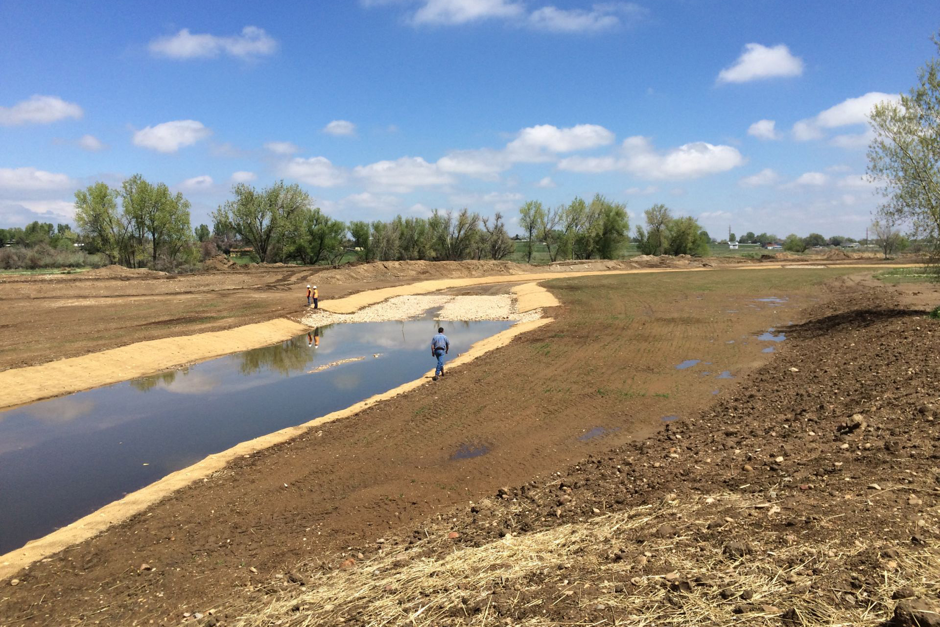
Boulder Creek just beginning to flow in its new channel and floodplain.
Dawn at the Bailey-Kenosha Ponds property.
This portion of the Boulder Valley has been an important part of the region for its streamside riparian habitats, its irrigated farmlands, and its aggregate resources. While extractive industries have impacted the site, the agricultural community, including the tenants of these county open space parcels, continues to steward this rural landscape. The area has been, and remains, a site for oil and gas operations. The county finished the reclamation of the last and most recent gravel operation and will continue to revegetate the site.
Due to the extent of past aggregate mining, the site continues to provide ongoing opportunities for restoration. In the latest example, the county partnered with the U.S. Army Corps of Engineers to fully restore a one-mile segment of the Boulder Creek floodplain east of US 287 several years ago, broadening the channel in order to build resilience into the landscape and to offer a larger riparian habitat footprint. Learn more about the restoration project.
The site also supports existing significant wildlife habitats and wetlands. Due to its relatively level topography and position on the western Great Plains, this site offers expansive views of the Front Range mountains and the Indian Peaks area. This site presents a variety of passive recreation options and a continued opportunity to restore this place for both the natural and human community.
Contact Us
Parks & Open Space
Obadiah Broughton
obroughton@bouldercounty.gov
303-918-2606