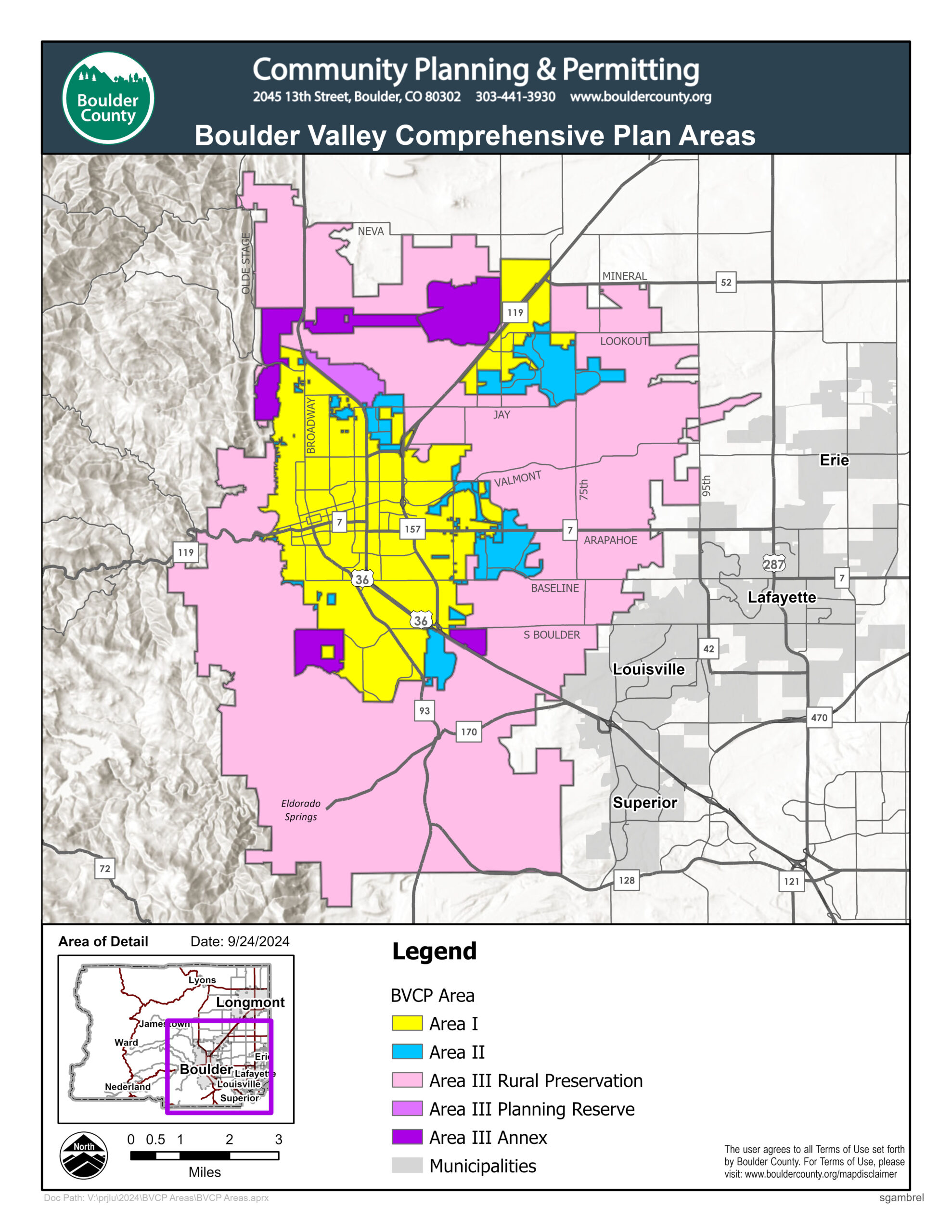
Stage 1 Fire Restrictions in effect for unincorporated plains areas east of Highway 93 (South Foothills), Broadway, and US 36 (North Foothills)

Boulder Valley Comprehensive Plan Major Update BVCP-25-0001

BVCP-25-0001: Boulder Valley Comprehensive Plan Major Update

The Boulder Valley Comprehensive Plan (BVCP) is the shared long‑range plan that guides land use, development, and community priorities for the City of Boulder and Boulder County.

Since the 1970s, the two jurisdictions have jointly adopted the Boulder Valley Comprehensive Plan (BVCP) to guide planning and development in the city and surrounding area. Every ten years the BVCP undergoes a major update to reflect changing conditions and community values. Initial scoping for the BVCP 2025 update began in 2024. The update will address a wide range of topics to ensure the plan provides a relevant vision as Boulder Valley looks ahead.

Boulder Valley Comprehensive Plan Update graphic with City of Boulder and Boulder County logos and message that says A Boulder Future.

Public Event

Community Open House on March 10, 4:30-7:30 p.m., Dairy Arts Center

View a variety of ways to engage with both staff and your fellow community members on Boulder Valley Comprehensive Plan on the A Boulder Future website.

Public Meetings

The BVCP is adopted by four government bodies: City of Boulder Planning Board, Boulder City Council, Boulder County Planning Commission, and the Boulder County Board of County Commissioners. Information on any upcoming meetings will be sent to the county and city email news lists.

Past Public Meetings

BOCC Public Meeting, Tuesday, Jan. 27, 2026

Documents:

Planning Commission Public Meeting, Jan. 21, 2026

Documents:

A Boulder Today

As we embark on the major update to the Boulder Valley Comprehensive Plan (BVCP) it’s important to understand the local context and trends of the Boulder Valley community, the environment and the region. This information will support community conversations and help policy-makers identify relevant issues for the update. This information also serves as a foundation for developing and refining future policies and metrics. View the newly published existing conditions story maps.

Boulder Valley Planning Area

The planning area encompasses the Boulder Valley, which is generally defined as those areas bounded by the mountain backdrop on the west, 95th Street on the east, Davidson Mesa and the Coal Creek drainage on the southeast, the south county line on the south, Mineral Road on the northeast and Neva Road and Niwot Road on the north. The plan includes the City of Boulder and portions of unincorporated Boulder County surrounding the city, including Gunbarrel (it does not include neighboring communities such as Niwot, Louisville, and Lafayette). The current boundaries of the planning area are as shown on the Planning Areas I, II, III Map.

Map showing the Boulder Valley Comprehensive Plan Areas.

View the Map Accessibility Disclaimer

Contact Us

Hours

Public Office Hours:
8 a.m. to 3 p.m., Monday, Wednesday, Thursday
10 a.m. to 3 p.m., Tuesday

Virtual Service Hours:
8 a.m. to 4:30 p.m., Monday, Wednesday, Thursday and Friday
10 a.m. to 4:30 p.m., Tuesday
Schedule an Appointment

Mailing Address

Community Planning & Permitting
PO Box 471
Boulder, CO 80306
Community Planning & Permitting website

Location

Courthouse Annex Building
2045 13th St.
Boulder, CO 80302