View or download PDF maps of open space properties, parks, and trails.
Parks, Trails, and Open Space Maps
Open Space PDF Map
 Open Space Map
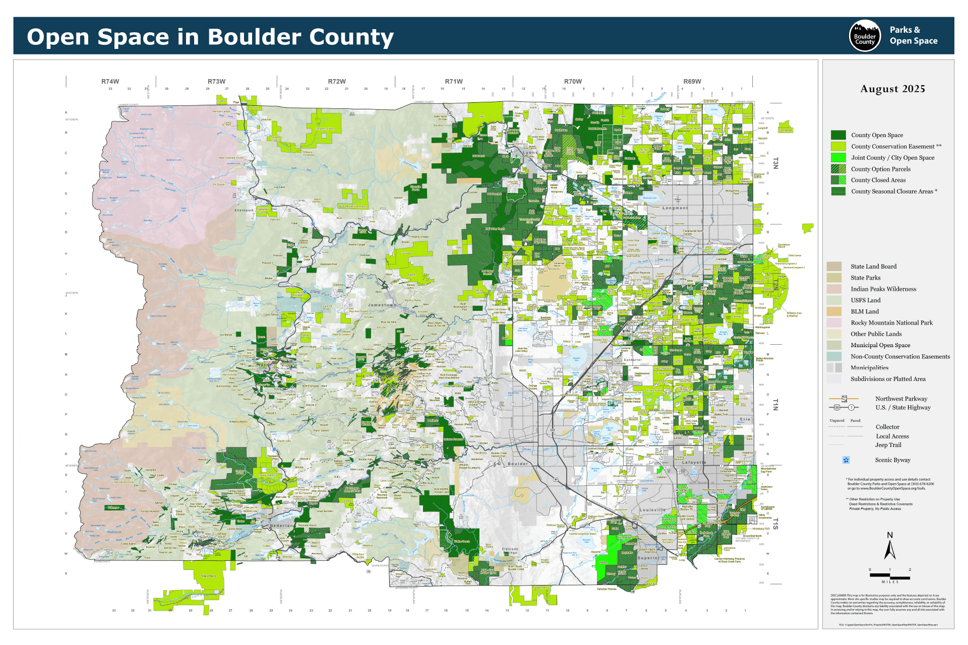
The open space map shows county open space, conservation easements, and other agency owned open space areas. The map is a georeferenced PDF. It can be used in apps like Avenza Maps that allow offline use and can use your device’s built-in GPS to track your location on the map.
PDF Maps For Specific Parks
Plains North
North of Highway 52 and east of the foothills
Plains South
South of Highway 52 and east of the foothills
Other PDF Maps
Accessibility Statement
Boulder County aims to ensure all digital content and documents are accessible. While efforts have been made to maximize accessibility, some types of content have inherent technical limitations. For alternate formats or accommodations, please submit an ADA Web Accommodation Request Form or email ada@bouldercounty.gov, or call 303-441-1386. View the county’s accessibility statement.