Boulder County government offices closed Tuesday, Dec. 24 (at noon), and Wednesday, Dec. 25, for the Christmas holiday.

US Highway 36 Intersection Improvement Project

US Highway 36 Intersection Improvement Project

Project Description

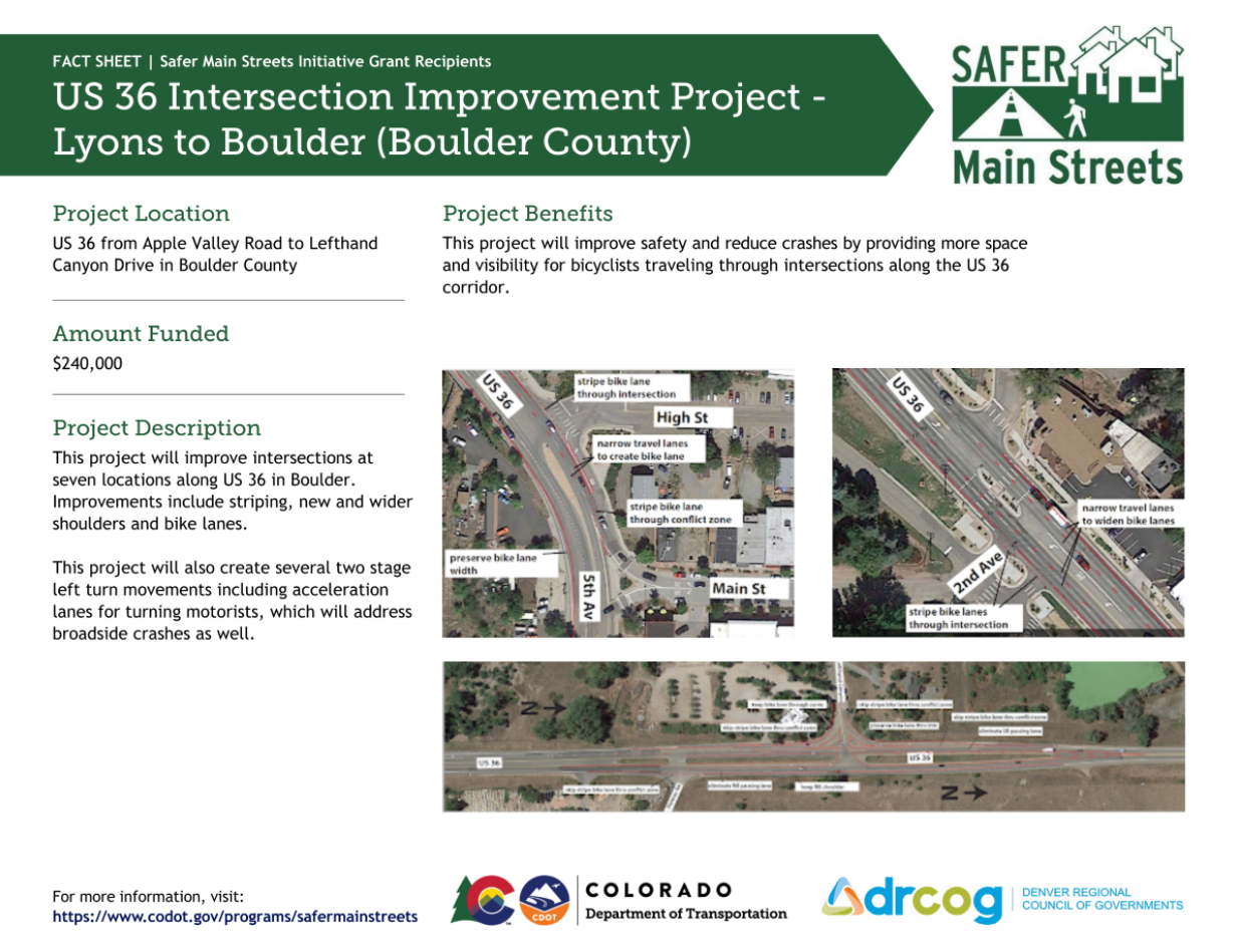
The US 36 (North Foothills Hwy.) Intersection Improvement Project is a partnership project between CDOT, Boulder County, and the Town of Lyons to improve intersection safety on US 36 between Lefthand Canyon Dr. and Apple Valley Rd. west of Lyons. In addition to repaving a section of US 36, the project will include striping changes and shoulder widening to increase space for bicyclists and to more clearly indicate conflict zones at intersections. The project is being funded by CDOT, Boulder County, and a Safer Main Streets grant.

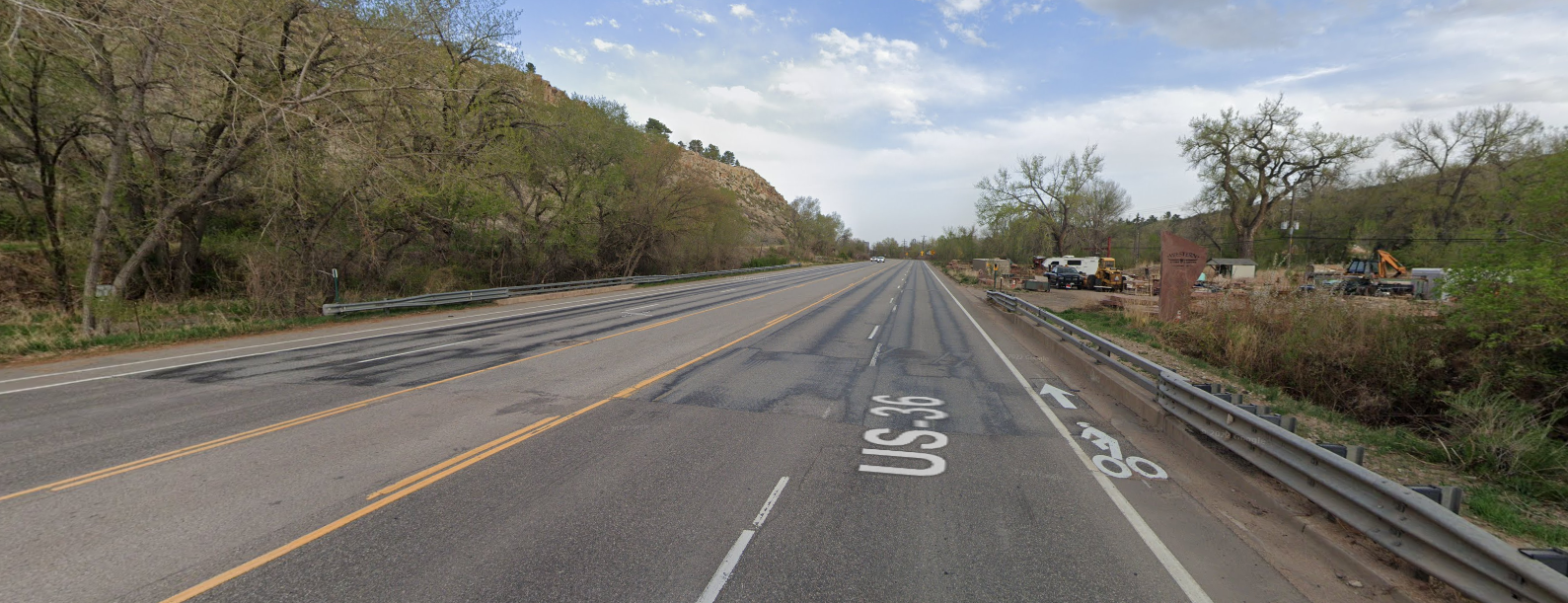
Image shows a stretch of US 36 with a narrow bike lane

Current condition of US 36 approaching the Town of Lyons by the Western Stone Company.

CDOT US 36 Safer Main Streets project information fact sheet

Project Funding

Project Schedule

  • Design Complete – Fall 2022
  • Advertise for Construction – Winter 2022-23
  • Begin Construction – Spring 2023
  • Complete Construction – Summer 2023

Changes by Location

US 36 & Lefthand Canyon Dr.

  • Striping modifications, related signage, and minor shouldering widening on the east side of US 36 to increase the shoulder width and highlight the bike lanes through the intersection at conflict points with turning motor vehicles
  • Creation of a shared SB right turn lane and bicycle through lane
  • Removal of pork chop islands and replacement with asphalt

US 36 & Nelson Rd.

  • Striping modifications, related signage, and shoulder widening on the east side of US 36 to separate the NB right turn lane and the through the bicycle lane

US 36 & St Vrain Rd.

  • Striping modifications and signage to highlight the location of bicyclists travelling northbound through the intersection
  • Creation of two stage WB to SB left turn movement for motor vehicles

US 36 & Hygiene Rd.

  • Striping modifications and signage to highlight the location of bicyclists in the intersection
  • Creation of a southbound shoulder where none currently exists
  • Elimination of unnecessary SB bus acceleration lane
  • Creation of two stage WB to SB left turn movement for motor vehicles

US 36 & SH 66

  • Striping modifications to preserve the bike lanes through the intersections and highlight the locations of bicyclists as they cross the EB to SB and NB to EB right turn slip lanes
  • Creation of a NB “bike box” to improve visibility of left turning NB to WB bicyclists at the intersection

US 36: SH 66 to 2nd Ave.

  • Striping modifications to widen the shoulders (from 2’ to 4-5’) and create more space for bicyclists
  • Skip striping to highlight the location of bicyclists at intersections and driveways
  • Narrow travel lanes from 12’ to 11’ in both directions to reduce motor vehicle speeds and create more room for additional shoulder and bike lane width

US 36: 5th Ave. to Apple Valley Rd.

  • Striping modifications to widen the shoulders/bike lanes and create more space for bicyclists, including the use of skipped striping at intersections to designate a space for bicyclists

CDOT Plans

Project Contacts

Boulder County Community Planning & Permitting
Alex Hyde-Wright, Principal Transportation Planner, 303-441-4910
Alexandra Phillips, Bike Planner, 303-441-4520

Contact Us

Community Planning & Permitting

Ask a Planner
Email: planner@bouldercounty.gov
Phone:303-441-3930

Courthouse Annex Building

2045 13th St.
Boulder, CO 80302

Hours

8 a.m. to 3 p.m. Monday, Wednesday, Thursday
10 a.m. to 3 p.m. Tuesday
Map and Directions

Mailing Address

Community Planning & Permitting
PO Box 471
Boulder, CO 80306
Community Planning & Permitting website