Jay Road serves as an important connector between Boulder and Gunbarrel and sees some of the highest vehicle and bicycle volumes of any county road. Unfortunately, it also has some of the highest numbers of bicycle-vehicle crashes of any unincorporated county road. Between 2006 and 2018, two-thirds of bicycle-vehicle crashes on Jay Road are the result of conflicts between turning vehicles and cyclists traveling straight.
As part of the Public Works Department’s and Community Planning & Permitting’s Transportation Planning Division, we have completed ongoing efforts to increase safety for all travelers. The following improvements have been installed:
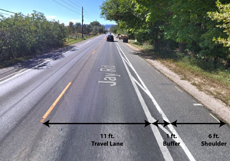
- Between 30th and 63rd streets – striping a one-foot buffer to separate the travel lane from the shoulder.
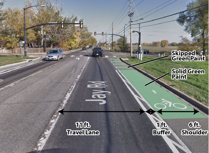
- Between 30th and 75th streets – applying green paint to the shoulder to highlight the shoulder and bike lane at intersections.
The image below shows what Jay Road will look like between 30th and 63rd streets.


Other Improvements
In 2021, completed a Jay Road intersection improvement project to improve pedestrian safety at 30th Street, St. Croix Street, and Lonetree Court. The project included adding pedestrian refuge islands that will help people safely cross one lane of Jay Road at a time, rather than having to find a gap in both east- and westbound traffic simultaneously. These improvements are taken from the Boulder County Mulitmodal Transportation Standards.
- Jay Road – St. Croix Pedestrian Crossing Designs
- Jay Road Pedestrian Refuge Island Design
- Jay Road – St. Croix Pedestrian Crossing Signage
- Multimodal Transportation Standards for Pedestrian Crossing Signage
LoBo Trail “Missing Link” Alternatives Analysis
We are currently considering different trail alignments that would complete the missing link in the LoBo Trail system along Jay/Spine Road. Visit the project website to learn more.
Project Contact:
- Andrew Barth – Communications – Email or 303-441-1032

